|
search place name
|
||
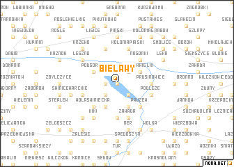
Bielawy (Poland)Bielawy is a town in Poland. An overview map of the region around Bielawy is displayed below.
regional and 3d topo map of Bielawy, Poland ::
Bielawy airports ::
The nearest airport is WAW - Warsaw Okecie, located 136.5 km east of Bielawy.
Other airports nearby include KTW - Katowice Pyrzowice (175.4 km south), KRK - Krakow Balice (226.5 km south), Nearby towns ::
Piaski (0.0km north) //
Grodzisko (1.1km west) //
Rogów (2.2km south west) //
Kolonia Bielawy (2.2km south east) //
Kosów Mały (2.2km north east) //
Kosów (2.2km north east) //
Saków (3.9km south) //
Drozdów (3.9km south) //
Podgórze (2.9km north west) //
Kosów Wielki (2.9km north east) //
Wola Świniecka (4.4km south west) //
Pauzew (4.4km south east) //
Nagórki (4.4km north east) //
Prusinowice (3.4km east) //
Dzierżawy (5.6km south) //
Byszew (5.7km north) //
Podłęże (3.9km south east) //
Zawada (5.7km south) //
Głogowiec (3.9km south west) //
Kolonia Piaski (5.7km north) //
Kiki (6.0km south) //
Leszno (5.0km north west) //
Piaski (7.4km north) //
Świnice Warckie (4.9km west) //
Ner (7.5km south) //
Grabiszew (6.5km south west) //
Krzewo (6.5km north west) //
Łęka (5.9km north east) //
Lisice (7.8km north) //
[all distances 'as the bird flies' and approximate]  Places with similar names to Bielawy, Poland ::
Disclaimer :: Information on this page comes without warranty of any kind |
||
|
Where is Bielawy? Elevation and coordinates ::
Latitude (lat): 52°3'0"N Longitude (lon): 18°59'0"E
Elevation (approx.): 95m (map arrows pan, magnifying glasses zoom) |
||
|
Visiting Bielawy? Hotel/Accommodation ::
Book a hotel in Bielawy Travel Guide ::
Buy a travel guide for Poland rental cars ::
car rental offers GPS waypoint ::
download a GPX waypoint (PoI) of Bielawy for your GPS receiver
|
||