|
search place name
|
||
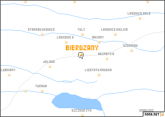
Bierdzany (Poland)Bierdzany is a town in Poland. An overview map of the region around Bierdzany is displayed below.
regional and 3d topo map of Bierdzany, Poland ::
Bierdzany airports ::
The nearest airport is KTW - Katowice Pyrzowice, located 76.0 km south east of Bierdzany.
Other airports nearby include WRO - Wroclaw Strachowice (94.3 km west), OSR - Ostrava Mosnov (124.7 km south), KRK - Krakow Balice (142.3 km south east), PRV - Prerov (163.6 km south), Nearby towns ::
Laskowice (4.4km north west) //
Bażany (4.4km north east) //
Ligota Turawska (4.4km south east) //
Beznatka (3.5km east) //
Tuły (5.6km north) //
Jełowa (5.0km west) //
Lasowice Wielkie (7.3km north east) //
[all distances 'as the bird flies' and approximate]  Places with similar names to Bierdzany, Poland ::
// Bretthausen (DE)
// Bretzin (DE)
// Bertesina (IT)
// Brudzeń (PL)
// Brudzyń (PL)
// Bartašiūnai (LT)
// Bardžūni (LV)
// Borduşani (RO)
// Borduşani (RO)
// Brădiceni (RO)
Disclaimer :: Information on this page comes without warranty of any kind |
||
|
Where is Bierdzany? Elevation and coordinates ::
Latitude (lat): 50°49'0"N Longitude (lon): 18°9'0"E
Elevation (approx.): 189m (map arrows pan, magnifying glasses zoom) |
||
|
Visiting Bierdzany? Hotel/Accommodation ::
Book a hotel in Bierdzany Travel Guide ::
Buy a travel guide for Poland rental cars ::
car rental offers GPS waypoint ::
download a GPX waypoint (PoI) of Bierdzany for your GPS receiver
|
||