|
search place name
|
||
Borki Sołdy (Poland)Borki Sołdy is a town in Poland. An overview map of the region around Borki Sołdy is displayed below.
regional and 3d topo map of Borki Sołdy, Poland ::

Borki Sołdy airports ::
The nearest airport is WAW - Warsaw Okecie, located 93.8 km west of Borki Sołdy.
Other airports nearby include RZE - Rzeszow Jasionka (222.5 km south), Nearby towns ::
Borki Kostorki (1.1km west) //
Borki Paduchy (2.2km south east) //
Borki Wyrki (2.2km north east) //
Ciosny (3.7km south) //
Ujrzanów (3.9km north) //
Białki (4.3km north west) //
Joachimów (4.3km north east) //
Chromna (3.4km east) //
Wiśniew (3.9km south west) //
Jasionka (3.9km south east) //
Ługi Wielkie (3.9km north east) //
Lipiny (5.0km north east) //
Grabianów (5.0km north west) //
Gostchorza (6.0km south) //
Okniny (7.4km south) //
Stok Lacki (7.5km north) //
Ługi Rętki (4.9km east) //
Grubale (6.5km north east) //
Jastrzębie Tworki (6.5km south west) //
Ulica Starowiejska (7.8km north) //
Siedlce (7.8km north) //
Rówce (5.9km south east) //
Zabłocie (7.8km south) //
Radomyśl (7.8km south) //
Kaczory (7.2km south west) //
Jastrzębie Pluty (8.2km south west) //
Dziewule (7.2km south east) //
Jastrzębie Daćbogi (8.7km south west) //
Pruszyn Pieńki (8.7km north east) //
[all distances 'as the bird flies' and approximate] 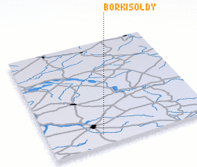 Places with similar names to Borki Sołdy, Poland ::
// Brakaslaut (ID)
Disclaimer :: Information on this page comes without warranty of any kind |
||
|
Where is Borki Sołdy? Elevation and coordinates ::
Latitude (lat): 52°6'0"N Longitude (lon): 22°20'0"E
Elevation (approx.): 152m (map arrows pan, magnifying glasses zoom) |
||
|
Visiting Borki Sołdy? Hotel/Accommodation ::
Book a hotel in Borki Sołdy Travel Guide ::
Buy a travel guide for Poland rental cars ::
car rental offers GPS waypoint ::
download a GPX waypoint (PoI) of Borki Sołdy for your GPS receiver
|
||