|
search place name
|
||
Budzeń (Poland)Budzeń is a town in Poland. An overview map of the region around Budzeń is displayed below.
regional and 3d topo map of Budzeń, Poland ::

Budzeń airports ::
The nearest airport is WAW - Warsaw Okecie, located 53.5 km north west of Budzeń.
Other airports nearby include RZE - Rzeszow Jasionka (202.8 km south), KRK - Krakow Balice (242.2 km south west), Nearby towns ::
Puznów Nowy (1.9km north) //
Leszczyny (1.1km east) //
Garwolin (1.9km south) //
Gracjanów (1.9km south) //
Jagodne (2.2km north west) //
Puznów (2.2km north east) //
Czyszków (2.2km south west) //
Zawady (2.2km south east) //
Niecieplin (2.3km east) //
Lucin (3.7km south) //
Żabieniec (3.9km north) //
Puznów Stary (2.9km north east) //
Natalia (3.9km south) //
Trąbki (4.4km north west) //
Czyszkówek (4.4km south west) //
Zofianów (4.4km south east) //
Miętne (3.9km north west) //
Sulbiny (5.7km south) //
Wygoda (6.0km north) //
Choiny (6.0km north) //
Sławiny (5.1km south east) //
Wola Rębkowska (4.9km west) //
Głosków (4.9km east) //
Taluba (7.5km south) //
Ruda Talubska (6.5km south west) //
Górki (6.5km south west) //
Parysów (6.5km north east) //
Mierzączka (6.5km south east) //
Niesadna (7.8km north) //
[all distances 'as the bird flies' and approximate] 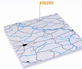 Places with similar names to Budzeń, Poland ::
Disclaimer :: Information on this page comes without warranty of any kind |
||
|
Where is Budzeń? Elevation and coordinates ::
Latitude (lat): 51°55'0"N Longitude (lon): 21°38'0"E
Elevation (approx.): 139m (map arrows pan, magnifying glasses zoom) |
||
|
Visiting Budzeń? Hotel/Accommodation ::
Book a hotel in Budzeń Travel Guide ::
Buy a travel guide for Poland rental cars ::
car rental offers GPS waypoint ::
download a GPX waypoint (PoI) of Budzeń for your GPS receiver
|
||