|
search place name
|
||
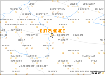
Butrymowce (Poland)Butrymowce is a town in Poland. An overview map of the region around Butrymowce is displayed below.
regional and 3d topo map of Butrymowce, Poland ::
Nearby towns ::
Kudrawka (1.9km south) //
Bieniowce (1.9km north) //
Grzebienie (2.2km south west) //
Siderka (3.7km south) //
Plebanowce (2.2km east) //
Synkowce (2.9km south east) //
Szostaki (3.9km south) //
Jaczno (2.9km north west) //
Dubaśna (4.3km north east) //
Chilmeny (5.7km north) //
Podsudki (6.0km south) //
Harasimowicze (5.0km north west) //
Grodziszczany (4.4km west) //
Różanystok (4.4km west) //
Sidra (7.5km south) //
Nowosiółki (7.5km north) //
Mościcha (5.8km south west) //
Łozowo (5.8km south west) //
Koniuszki (7.7km north) //
Rogożyniec (7.7km north) //
Staworowo (7.1km south east) //
Berwicha (8.1km south west) //
Siruciowce (7.1km north east) //
Ostrowo (7.1km north west) //
Słomianka (8.6km south west) //
[all distances 'as the bird flies' and approximate]  Places with similar names to Butrymowce, Poland ::
// Betorimaso (MG)
// Bţurmāz (LB)
Disclaimer :: Information on this page comes without warranty of any kind |
||
|
Where is Butrymowce? Elevation and coordinates ::
Latitude (lat): 53°38'0"N Longitude (lon): 23°28'0"E
Elevation (approx.): 137m (map arrows pan, magnifying glasses zoom) |
||
|
Visiting Butrymowce? Hotel/Accommodation ::
Book a hotel in Butrymowce Travel Guide ::
Buy a travel guide for Poland rental cars ::
car rental offers GPS waypoint ::
download a GPX waypoint (PoI) of Butrymowce for your GPS receiver
|
||