|
search place name
|
||
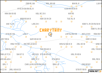
Charytany (Poland)Charytany is a town in Poland. An overview map of the region around Charytany is displayed below.
regional and 3d topo map of Charytany, Poland ::
Charytany airports ::
The nearest airport is RZE - Rzeszow Jasionka, located 68.2 km west of Charytany.
Other airports nearby include LWO - Lvov Lviv Intl (74.7 km east), KSC - Kosice (192.3 km south west), Nearby towns ::
Piaski (1.2km west) //
Babiaki (2.2km north east) //
Wola Zaleska (2.4km east) //
Dąbrowa (2.4km east) //
Chałupki Nienowskie (4.4km south west) //
Gaje (4.4km south east) //
Chałupki Zaleskie (3.6km east) //
Duńkowice (4.0km south west) //
Nienowice (5.7km south) //
Korzenica (5.7km north) //
Miękisz Stary (5.7km north) //
Hruszowice (5.2km south east) //
Miękisz Nowy (6.0km north east) //
Laszki (5.1km north west) //
Chałupki Chotynieckie (4.8km east) //
Łapajówka (4.8km east) //
Stubienko (7.5km south) //
Chotyniec (6.0km south east) //
Grabowiec (6.0km south west) //
Michałówka (6.0km south west) //
Kołaczki (7.8km north) //
Skład Solny (8.2km south west) //
Brzeg (8.2km south west) //
Tuchla (7.3km north east) //
Hirne (8.8km north east) //
[all distances 'as the bird flies' and approximate]  Places with similar names to Charytany, Poland ::
Disclaimer :: Information on this page comes without warranty of any kind |
||
|
Where is Charytany? Elevation and coordinates ::
Latitude (lat): 49°59'0"N Longitude (lon): 22°57'0"E
Elevation (approx.): 196m (map arrows pan, magnifying glasses zoom) |
||
|
Visiting Charytany? Hotel/Accommodation ::
Book a hotel in Charytany Travel Guide ::
Buy a travel guide for Poland rental cars ::
car rental offers GPS waypoint ::
download a GPX waypoint (PoI) of Charytany for your GPS receiver
|
||