|
search place name
|
||
Chlistawy (Poland)Chlistawy is a town in Poland. An overview map of the region around Chlistawy is displayed below.
regional and 3d topo map of Chlistawy, Poland ::

Chlistawy airports ::
The nearest airport is RZE - Rzeszow Jasionka, located 32.9 km south east of Chlistawy.
Other airports nearby include KRK - Krakow Balice (140.8 km west), TAT - Poprad Tatry (175.9 km south west), KSC - Kosice (188.9 km south), WAW - Warsaw Okecie (210.5 km north), Nearby towns ::
Komorów (2.2km north east) //
Jagodnik (2.2km south west) //
Hadykówka (3.0km south east) //
Cmolas (4.4km south east) //
Grabina (5.6km north) //
Dąbrówka (5.6km south) //
Majdan Królewski (6.0km north east) //
Plac (6.0km south west) //
Trzęsówka (6.0km south west) //
Huta Komorowska (7.4km north) //
Izdebnik (7.5km south) //
Dubas (7.8km south) //
Poręby Majdańskie (7.8km north) //
Ostrowy Tuszowskie (6.0km south west) //
Brzostowa Góra (7.3km north east) //
Siedlanka (8.2km south west) //
Kosowy (7.3km south west) //
Zarąbki (8.8km south east) //
[all distances 'as the bird flies' and approximate] 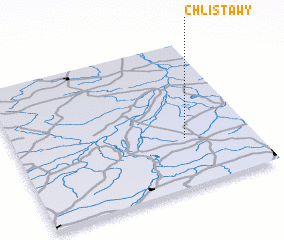 Places with similar names to Chlistawy, Poland ::
// Shale City (US)
// Chełst (PL)
// Chełst (PL)
// Chełsty (PL)
// Chełsty (PL)
// Chelīsād (IR)
// Tialo Zoudou (TD)
// Chilecito (CL)
// Shelesat (IR)
// Chilecito (AR)
Disclaimer :: Information on this page comes without warranty of any kind |
||
|
Where is Chlistawy? Elevation and coordinates ::
Latitude (lat): 50°20'0"N Longitude (lon): 21°43'0"E
Elevation (approx.): 197m (map arrows pan, magnifying glasses zoom) |
||
|
Visiting Chlistawy? Hotel/Accommodation ::
Book a hotel in Chlistawy Travel Guide ::
Buy a travel guide for Poland rental cars ::
car rental offers GPS waypoint ::
download a GPX waypoint (PoI) of Chlistawy for your GPS receiver
|
||