|
search place name
|
||
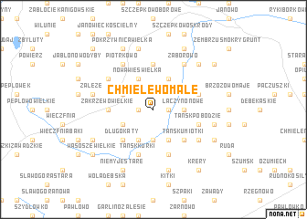
Chmielewo Małe (Poland)Chmielewo Małe is a town in Poland. An overview map of the region around Chmielewo Małe is displayed below.
regional and 3d topo map of Chmielewo Małe, Poland ::
Chmielewo Małe airports ::
The nearest airport is WAW - Warsaw Okecie, located 119.8 km south of Chmielewo Małe.
Other airports nearby include KGD - Kaliningrad Khrabrovo (186.3 km north), Nearby towns ::
Chmielewo Wielkie (1.1km west) //
Chmielewo (1.1km west) //
Łączyno Stare (1.1km east) //
Grzebsk (1.1km east) //
Tańsk Grzymki (3.7km south) //
Łączyno Nowe (2.2km east) //
Łęg (2.9km north west) //
Nowa Wieś Wielka (3.9km north) //
Długokąty Kobiałki (2.9km south west) //
Krusze (3.9km north) //
Długokąty Wielkie (3.9km south) //
Tańsk Chorąże (3.9km south) //
Tańsk (3.9km south) //
Długokąty (4.3km south west) //
Tańsk Umiotki (4.3km south east) //
Zakrzewo Ranki (3.3km west) //
Zakrzewo Wielkie (3.3km west) //
Waśniewo-Grabowo (5.6km north) //
Tańsk Kurki (5.7km south) //
Tańsk Wasiły (5.7km south) //
Brzozowo Czary (3.8km north east) //
Dobrogosty Tańsk (5.7km south) //
Tańsk Pobodzie (3.8km south east) //
Bielawy (5.0km north west) //
Piotrkowo (6.0km north) //
Tańsk Kiernozy (5.0km south east) //
Kolonia Dziergówek (5.0km south east) //
Zaborowo (6.0km north) //
Załęże (4.8km north west) //
[all distances 'as the bird flies' and approximate] 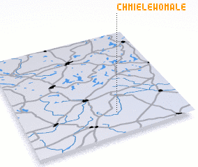 Places with similar names to Chmielewo Małe, Poland :: Disclaimer :: Information on this page comes without warranty of any kind |
||
|
Where is Chmielewo Małe? Elevation and coordinates ::
Latitude (lat): 53°13'0"N Longitude (lon): 20°35'0"E
Elevation (approx.): 138m (map arrows pan, magnifying glasses zoom) |
||
|
Visiting Chmielewo Małe? Hotel/Accommodation ::
Book a hotel in Chmielewo Małe Travel Guide ::
Buy a travel guide for Poland rental cars ::
car rental offers GPS waypoint ::
download a GPX waypoint (PoI) of Chmielewo Małe for your GPS receiver
|
||