|
search place name
|
||
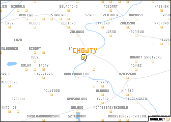
Chojty (Poland)Chojty is a town in Poland. An overview map of the region around Chojty is displayed below.
regional and 3d topo map of Chojty, Poland ::
Chojty airports ::
The nearest airport is GDN - Gdansk Lecha Walesy, located 69.5 km north west of Chojty.
Other airports nearby include KGD - Kaliningrad Khrabrovo (134.0 km north east), WAW - Warsaw Okecie (230.6 km south east), Nearby towns ::
Budzisz (2.2km north east) //
Poliksy (2.2km south east) //
Trankwice (2.2km north west) //
Ankamaty (3.9km south) //
Waplewo Wielkie (3.9km south) //
Ramoty (3.9km south) //
Andrzejewo (5.7km south) //
Żuławka (5.7km north) //
Morany (6.0km south) //
Jasna (6.4km north east) //
Stalewo (7.7km north) //
Złotowo (7.7km north) //
Blunaki (7.7km south) //
Nowy Targ (8.6km south west) //
[all distances 'as the bird flies' and approximate] 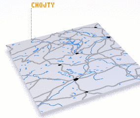 Places with similar names to Chojty, Poland ::
Disclaimer :: Information on this page comes without warranty of any kind |
||
|
Where is Chojty? Elevation and coordinates ::
Latitude (lat): 53°58'0"N Longitude (lon): 19°16'0"E
Elevation (approx.): 42m (map arrows pan, magnifying glasses zoom) |
||
|
Visiting Chojty? Hotel/Accommodation ::
Book a hotel in Chojty Travel Guide ::
Buy a travel guide for Poland rental cars ::
car rental offers GPS waypoint ::
download a GPX waypoint (PoI) of Chojty for your GPS receiver
|
||