|
search place name
|
||
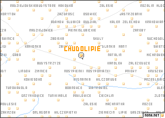
Chudolipie (Poland)Chudolipie is a town in Poland. An overview map of the region around Chudolipie is displayed below.
regional and 3d topo map of Chudolipie, Poland ::
Chudolipie airports ::
The nearest airport is WAW - Warsaw Okecie, located 33.2 km north east of Chudolipie.
Other airports nearby include KTW - Katowice Pyrzowice (196.8 km south west), KRK - Krakow Balice (216.6 km south), RZE - Rzeszow Jasionka (226.6 km south east), Nearby towns ::
Dwórzno (1.1km west) //
Grzegorzewice (1.9km north) //
Zimna Woda (2.2km south west) //
Parcele PetryKozy (2.2km south east) //
Kaczków (3.9km north) //
Lutkówka (3.9km south) //
Nosy Pieńki (3.9km south) //
Zbiroża (2.9km north west) //
Piotrkowice (2.9km north east) //
Budy Petrykoskie (2.9km south east) //
Kamionka (4.4km north west) //
Skuły (4.4km north east) //
Bartoszówka (4.4km north east) //
Nosy Poniatki (4.4km south east) //
Pieńki Słubickie (5.6km north) //
Wygnanka (5.6km south) //
Redlanka (3.9km north east) //
Krze Duże (6.0km north) //
Ciemne Gnojna (5.0km north west) //
Zboiska (5.0km north west) //
Osuchów (6.0km south) //
Cychry (6.0km south) //
Oddział Stary (7.4km north) //
Natalin (4.6km east) //
Suszeniec (7.4km south) //
Bronisławów (4.9km west) //
Budy Strzyże (4.9km west) //
Bieniewice (7.5km north) //
Słubica (7.5km north) //
[all distances 'as the bird flies' and approximate]  Places with similar names to Chudolipie, Poland :: Disclaimer :: Information on this page comes without warranty of any kind |
||
|
Where is Chudolipie? Elevation and coordinates ::
Latitude (lat): 51°57'0"N Longitude (lon): 20°38'0"E
Elevation (approx.): 178m (map arrows pan, magnifying glasses zoom) |
||
|
Visiting Chudolipie? Hotel/Accommodation ::
Book a hotel in Chudolipie Travel Guide ::
Buy a travel guide for Poland rental cars ::
car rental offers GPS waypoint ::
download a GPX waypoint (PoI) of Chudolipie for your GPS receiver
|
||