|
search place name
|
||
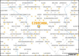
Czerchów (Poland)Czerchów is a town in Poland. An overview map of the region around Czerchów is displayed below.
regional and 3d topo map of Czerchów, Poland ::
Czerchów airports ::
The nearest airport is WAW - Warsaw Okecie, located 113.8 km east of Czerchów.
Other airports nearby include KTW - Katowice Pyrzowice (168.8 km south), KRK - Krakow Balice (214.3 km south), Nearby towns ::
Maszkowice (1.9km south) //
Helenów (1.9km south) //
Kolonia Maszkowice (2.2km south west) //
Boczki (3.7km north) //
Krzeszew (3.9km south) //
Sokolniki (2.9km south east) //
Ambrożew (3.9km north) //
Małachowice (2.9km north east) //
Skotniki (3.9km north) //
Krzeszew Szlachecki (4.4km south west) //
Krzeszew Rządowy (5.6km south) //
Modlna (3.4km east) //
Gębice (3.4km west) //
Kosin (5.6km north) //
Ozorków (3.9km south west) //
Bogdańczew (5.7km north) //
Słowik (5.7km south) //
Cedrowice (3.9km north west) //
Ostrów (3.9km north west) //
Kowalewice (6.0km south) //
Konstancja (5.0km south west) //
Kosiorów (6.0km north) //
Kania Góra (6.0km south) //
Śladków Podleśny (5.0km north east) //
Karsznice (6.0km north) //
Zimna Woda (7.4km south) //
Śliwniki (4.9km west) //
Parzyce (4.9km west) //
Brachowice (4.9km east) //
[all distances 'as the bird flies' and approximate]  Places with similar names to Czerchów, Poland ::
// Gueza Rash (IQ)
// Kisorichi (UA)
// Casariche (ES)
// Kezoruchey (RU)
// Kozarichi (RU)
// Kūzeh Rash (IR)
// Kasarichi (BY)
Disclaimer :: Information on this page comes without warranty of any kind |
||
|
Where is Czerchów? Elevation and coordinates ::
Latitude (lat): 51°59'0"N Longitude (lon): 19°20'0"E
Elevation (approx.): 121m (map arrows pan, magnifying glasses zoom) |
||
|
Visiting Czerchów? Hotel/Accommodation ::
Book a hotel in Czerchów Travel Guide ::
Buy a travel guide for Poland rental cars ::
car rental offers GPS waypoint ::
download a GPX waypoint (PoI) of Czerchów for your GPS receiver
|
||