|
search place name
|
||
Dąbrowa (Poland)Dąbrowa is a town in Poland. An overview map of the region around Dąbrowa is displayed below.
regional and 3d topo map of Dąbrowa, Poland ::

Dąbrowa airports ::
The nearest airport is WAW - Warsaw Okecie, located 155.5 km south west of Dąbrowa.
Nearby towns ::
Czajki (1.9km south) //
Kobylino-Cieszymy (2.2km north west) //
Kobylino-Latki (2.2km west) //
Makowo (2.2km west) //
Kobylino-Borzymy (2.2km west) //
Truskolasy Stare (3.7km south) //
Kobylino-Pieniążki (2.9km north west) //
Kropiwnica Racibory (2.9km north east) //
Kobylino (3.9km north) //
Kobylino-Pogorzałki (3.9km north) //
Truskolasy Wola (4.3km south west) //
Jabłonowo (4.3km south east) //
Jabłonowo Kąty (4.3km south east) //
Truskolasy (5.6km south) //
Truskolasy Niwisko (5.6km south) //
Jeżewo Nowe (5.6km north) //
Truskolasy Lachy (5.6km south) //
Jabłonowo Wypychy (5.7km south) //
Truskolasy Olszyna (5.7km south) //
Idźki Młynowskie (5.7km south) //
Kobylino-Kruszewo (3.8km north west) //
Kropiwnica Gajki (3.8km north east) //
Jamiołki (6.0km south) //
Stare Jeżewo (6.0km north) //
Idźki Wykno (7.4km south) //
Kapice (7.4km north) //
Garbowo Stare (4.5km west) //
Chomice (4.5km east) //
Mojsiki (4.5km east) //
[all distances 'as the bird flies' and approximate] 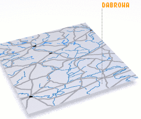 Places with similar names to Dąbrowa, Poland ::
Disclaimer :: Information on this page comes without warranty of any kind |
||
|
Where is Dąbrowa? Elevation and coordinates ::
Latitude (lat): 53°5'0"N Longitude (lon): 22°42'0"E
Elevation (approx.): 143m (map arrows pan, magnifying glasses zoom) |
||
|
Visiting Dąbrowa? Hotel/Accommodation ::
Book a hotel in Dąbrowa Travel Guide ::
Buy a travel guide for Poland rental cars ::
car rental offers GPS waypoint ::
download a GPX waypoint (PoI) of Dąbrowa for your GPS receiver
|
||