|
search place name
|
||
Daleszyn (Poland)Daleszyn is a town in Poland. An overview map of the region around Daleszyn is displayed below.
regional and 3d topo map of Daleszyn, Poland ::

Daleszyn airports ::
The nearest airport is POZ - Poznan Lawica, located 58.8 km north of Daleszyn.
Other airports nearby include IEG - Zielona Gora Babimost (84.5 km west), WRO - Wroclaw Strachowice (88.9 km south), PED - Pardubice (226.9 km south west), Nearby towns ::
Stary Gostyń (2.2km north west) //
Gola (2.2km south west) //
Dusina (2.3km east) //
Osowo Nowe (3.9km north) //
Stężyca (3.9km north) //
Brzezie (4.4km south east) //
Sikorzyn (5.7km south) //
Czachorowo (5.7km south) //
Brzezie Huby (5.7km south) //
Gostyń (3.9km south east) //
Czajkowo (5.7km south) //
Stankowo (3.9km north west) //
Kunowo (5.0km north east) //
Dalabuszki Nowe (6.0km north) //
Bielewo (6.0km north) //
Kosowo (4.6km west) //
Grabonóg (5.9km south east) //
Podrzecze (5.9km south east) //
Grodzisko (7.8km south) //
Tworzymirki (7.2km north east) //
Krajewice (8.7km south east) //
Lubiń (8.7km north west) //
[all distances 'as the bird flies' and approximate] 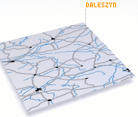 Places with similar names to Daleszyn, Poland ::
// Tall Sūsīn (SY)
Disclaimer :: Information on this page comes without warranty of any kind |
||
|
Where is Daleszyn? Elevation and coordinates ::
Latitude (lat): 51°54'0"N Longitude (lon): 16°58'0"E
Elevation (approx.): 109m (map arrows pan, magnifying glasses zoom) |
||
|
Visiting Daleszyn? Hotel/Accommodation ::
Book a hotel in Daleszyn Travel Guide ::
Buy a travel guide for Poland rental cars ::
car rental offers GPS waypoint ::
download a GPX waypoint (PoI) of Daleszyn for your GPS receiver
|
||