|
search place name
|
||
Darżlubie (Poland)Darżlubie is a town in Poland. An overview map of the region around Darżlubie is displayed below.
regional and 3d topo map of Darżlubie, Poland ::

Darżlubie airports ::
The nearest airport is GDN - Gdansk Lecha Walesy, located 38.7 km south of Darżlubie.
Other airports nearby include OSP - Slupsk Redzikowo (83.5 km west), Nearby towns ::
Połczyno (1.1km east) //
Werblinia (3.9km north) //
Sławutowo (3.9km south) //
Brudzewo (3.9km south) //
Mechowo (3.2km west) //
Łebcz (5.6km north) //
Starzyński Dwór (5.7km north) //
Gnieżdżewo (4.9km north east) //
Bieszki (4.9km south west) //
Strzelno (7.5km north) //
Rekowo (7.5km south) //
Sławutówko (6.4km south east) //
Starzyno (5.7km north west) //
Radoszewo (7.0km north west) //
Połchowo (8.1km south east) //
Swarzewo (7.0km north east) //
Wielka Wieś (8.6km north east) //
[all distances 'as the bird flies' and approximate] 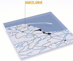 Places with similar names to Darżlubie, Poland ::
// Dar Salah Bey (TN)
// Dār Şāliḩ Bey (TN)
// Dayr aş Şalīb (SY)
// Dayr Şalībah (SY)
// Ḑahr aş Şulayyib (LB)
// Dayr aş Şalīb (LB)
// Douar Selehbia (DZ)
Disclaimer :: Information on this page comes without warranty of any kind |
||
|
Where is Darżlubie? Elevation and coordinates ::
Latitude (lat): 54°43'0"N Longitude (lon): 18°20'0"E
Elevation (approx.): 4m (map arrows pan, magnifying glasses zoom) |
||
|
Visiting Darżlubie? Hotel/Accommodation ::
Book a hotel in Darżlubie Travel Guide ::
Buy a travel guide for Poland rental cars ::
car rental offers GPS waypoint ::
download a GPX waypoint (PoI) of Darżlubie for your GPS receiver
|
||