|
search place name
|
||
Dobaczewo (Poland)Dobaczewo is a town in Poland. An overview map of the region around Dobaczewo is displayed below.
regional and 3d topo map of Dobaczewo, Poland ::

Dobaczewo airports ::
The nearest airport is WAW - Warsaw Okecie, located 119.6 km south east of Dobaczewo.
Other airports nearby include GDN - Gdansk Lecha Walesy (188.4 km north), Nearby towns ::
Budy Bledzewskie (1.1km east) //
Zglenice Budy (1.9km south) //
Choczeń (2.2km south west) //
Podwierzbie (3.9km north) //
Zochowo (3.9km north) //
Sudragi (3.9km north) //
Sułocin Towarzystwo (4.3km north east) //
Karlewo (4.3km south east) //
Zglenice Duże (4.3km south east) //
Żuki (4.3km south east) //
Kapuśniki (4.3km north west) //
Żurawin (4.3km south west) //
Mochowo (5.6km south) //
Bledzewo (3.4km east) //
Żóltowo (5.7km south) //
Miłobędzin (3.8km north east) //
Śniechy (3.8km north west) //
Sułocin Teodory (5.7km north) //
Mochowo Rumunki (6.0km south) //
Malanowo Stare (5.0km south west) //
Pawłowo (6.0km north) //
Osówka (7.4km north) //
Dobrzenice Małe (7.4km south) //
Ligówko (4.5km west) //
Majewo (7.5km north) //
Całownia (7.5km north) //
Kręczkowo (4.8km east) //
Piastowo Parcele (4.8km east) //
Dobrzenice Duże (7.5km south) //
[all distances 'as the bird flies' and approximate] 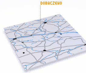 Places with similar names to Dobaczewo, Poland :: Disclaimer :: Information on this page comes without warranty of any kind |
||
|
Where is Dobaczewo? Elevation and coordinates ::
Latitude (lat): 52°49'0"N Longitude (lon): 19°34'0"E
Elevation (approx.): 100m (map arrows pan, magnifying glasses zoom) |
||
|
Visiting Dobaczewo? Hotel/Accommodation ::
Book a hotel in Dobaczewo Travel Guide ::
Buy a travel guide for Poland rental cars ::
car rental offers GPS waypoint ::
download a GPX waypoint (PoI) of Dobaczewo for your GPS receiver
|
||