|
search place name
|
||
Domaniew (Poland)Domaniew is a town in Poland. An overview map of the region around Domaniew is displayed below.
regional and 3d topo map of Domaniew, Poland ::

Domaniew airports ::
The nearest airport is WAW - Warsaw Okecie, located 13.9 km east of Domaniew.
Other airports nearby include KTW - Katowice Pyrzowice (223.5 km south west), Nearby towns ::
Moszna (1.1km west) //
Koszajec (2.2km south west) //
Domaniewek (2.2km north west) //
Parzniew (3.7km south) //
Duchnice (2.9km north east) //
Krosna (2.9km south west) //
Ołtarzew (3.9km north) //
Płochocin (4.3km north west) //
Kręczki (5.6km north) //
Kanie (5.6km south) //
Kaputy (5.7km north) //
Nowa Wieś (5.7km south) //
Brwinów (5.0km south west) //
Miasto Ogród Komorów (5.0km south east) //
Ostoja (5.0km south east) //
Granica (6.0km south) //
Wolskie (5.0km north west) //
Pogroszew (6.0km north) //
Ożarów-Franciszków (5.0km north east) //
Zaborów (7.4km south) //
Umiastów (7.4km north) //
Pruszków (4.9km east) //
Tworki (4.9km east) //
Wojcieszyn (7.5km north) //
Józefów (4.9km west) //
Borzęcin Mały (6.5km north west) //
Wieruchów (6.5km north east) //
Komorów (6.5km south east) //
Strzeniówka (7.8km south) //
[all distances 'as the bird flies' and approximate] 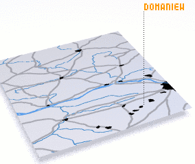 Places with similar names to Domaniew, Poland ::
Disclaimer :: Information on this page comes without warranty of any kind |
||
|
Where is Domaniew? Elevation and coordinates ::
Latitude (lat): 52°11'0"N Longitude (lon): 20°46'0"E
Elevation (approx.): 87m (map arrows pan, magnifying glasses zoom) |
||
|
Visiting Domaniew? Hotel/Accommodation ::
Book a hotel in Domaniew Travel Guide ::
Buy a travel guide for Poland rental cars ::
car rental offers GPS waypoint ::
download a GPX waypoint (PoI) of Domaniew for your GPS receiver
|
||