|
search place name
|
||
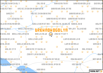
Drewnowo Gołyń (Poland)Drewnowo Gołyń is a town in Poland. An overview map of the region around Drewnowo Gołyń is displayed below.
regional and 3d topo map of Drewnowo Gołyń, Poland ::
Drewnowo Gołyń airports ::
The nearest airport is WAW - Warsaw Okecie, located 118.1 km south west of Drewnowo Gołyń.
Nearby towns ::
Zawisty Koziany (1.1km east) //
Stokowo (2.2km north west) //
Stokowo Bućki (2.2km north west) //
Zawisty Kruki (2.2km north east) //
Zawisty (2.2km north east) //
Zawisty Dworaki (2.2km north east) //
Drewnowo Lipskie (2.2km south west) //
Sienica Jasiochy (3.7km north) //
Sienica Daćbogi (3.7km north) //
Białe Zieje (2.2km west) //
Białe Szczepanowice (2.2km west) //
Kutyłowo Perysie (2.2km east) //
Zawisty Wity (2.2km east) //
Stokowo Szerszenie (2.9km north west) //
Stokowo Złotki (2.9km north west) //
Zawisty Piotrowice (2.9km north east) //
Zawisty Króle (2.9km north east) //
Sienica Karasie (3.9km north) //
Sienica Klawy (3.9km north) //
Sienica (3.9km north) //
Sienica Pierce (3.9km north) //
Godlewo Baćki (3.9km north) //
Białe (2.9km south west) //
Białe Kwaczoły (2.9km south west) //
Złotki Stara Wieś (2.9km south east) //
Złotki (2.9km south east) //
Złotki Przeczki (2.9km south east) //
Złotki Pułapki (2.9km south east) //
Boguty-Pianki (3.9km south) //
[all distances 'as the bird flies' and approximate] 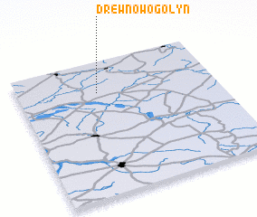 Places with similar names to Drewnowo Gołyń, Poland :: Disclaimer :: Information on this page comes without warranty of any kind |
||
|
Where is Drewnowo Gołyń? Elevation and coordinates ::
Latitude (lat): 52°46'0"N Longitude (lon): 22°24'0"E
Elevation (approx.): 135m (map arrows pan, magnifying glasses zoom) |
||
|
Visiting Drewnowo Gołyń? Hotel/Accommodation ::
Book a hotel in Drewnowo Gołyń Travel Guide ::
Buy a travel guide for Poland rental cars ::
car rental offers GPS waypoint ::
download a GPX waypoint (PoI) of Drewnowo Gołyń for your GPS receiver
|
||