|
search place name
|
||
Drogoszewo (Poland)Drogoszewo is a town in Poland. An overview map of the region around Drogoszewo is displayed below.
regional and 3d topo map of Drogoszewo, Poland ::

Drogoszewo airports ::
The nearest airport is WAW - Warsaw Okecie, located 122.2 km south west of Drogoszewo.
Other airports nearby include KGD - Kaliningrad Khrabrovo (208.4 km north), Nearby towns ::
Kuleszka (1.9km south) //
Rybaki (3.7km north) //
Sosnowiec (2.9km south east) //
Rydzewo (2.9km south west) //
Osetno (2.9km north west) //
Nowosiedliny (3.3km west) //
Zaruzie (3.3km east) //
Czartoria (5.7km north) //
Nowe Przytuły (5.7km south) //
Rozwory (5.7km south) //
Miastkowo (3.8km north east) //
Łątczyn (6.0km south) //
Gontarze (6.0km north) //
Tabory-Rzym (7.4km north) //
Dzbenin (7.4km south) //
Puchały (7.5km south) //
Zabiele (6.5km south west) //
Kurpiewskie Stare (5.8km north west) //
Stanisławowo (5.8km north west) //
Ruda Osowiecka (7.7km north) //
Jankowo-Młodzianowo (7.1km north east) //
Jankowo (7.1km north east) //
Ołdaki (7.1km south west) //
Budne (8.1km south east) //
Barszcze (7.1km north west) //
[all distances 'as the bird flies' and approximate] 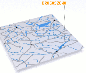 Places with similar names to Drogoszewo, Poland :: Disclaimer :: Information on this page comes without warranty of any kind |
||
|
Where is Drogoszewo? Elevation and coordinates ::
Latitude (lat): 53°9'0"N Longitude (lon): 21°46'0"E
Elevation (approx.): 102m (map arrows pan, magnifying glasses zoom) |
||
|
Visiting Drogoszewo? Hotel/Accommodation ::
Book a hotel in Drogoszewo Travel Guide ::
Buy a travel guide for Poland rental cars ::
car rental offers GPS waypoint ::
download a GPX waypoint (PoI) of Drogoszewo for your GPS receiver
|
||