|
search place name
|
||
Dynów (Poland)Dynów is a town in Poland. An overview map of the region around Dynów is displayed below.
regional and 3d topo map of Dynów, Poland ::

Dynów airports ::
The nearest airport is RZE - Rzeszow Jasionka, located 36.1 km north west of Dynów.
Other airports nearby include LWO - Lvov Lviv Intl (124.0 km east), KSC - Kosice (147.2 km south west), TAT - Poprad Tatry (166.4 km south west), Nearby towns ::
Bartkówka (2.4km east) //
Harta Dolna (3.9km north) //
Nozdrzec (3.9km south) //
Dąbrówka Starzeńska (3.9km south) //
Pawłokoma (3.6km east) //
Bachórz (4.0km north east) //
Wara (5.7km south) //
Siedliska (5.7km south) //
Lipnik (5.7km north) //
Ulanica (5.2km north west) //
Harta (6.1km north west) //
Łubno (4.8km west) //
Szklary (7.5km north) //
Dylągowa (6.1km south east) //
Poręby (7.8km south) //
Jawornik Polski (8.2km north east) //
Harta Górna (8.2km north west) //
Laskówka (7.3km north east) //
Piątkowa (8.8km north west) //
Huta (8.8km south east) //
[all distances 'as the bird flies' and approximate] 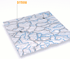 Places with similar names to Dynów, Poland ::
Disclaimer :: Information on this page comes without warranty of any kind |
||
|
Where is Dynów? Elevation and coordinates ::
Latitude (lat): 49°49'0"N Longitude (lon): 22°14'0"E
Elevation (approx.): 246m (map arrows pan, magnifying glasses zoom) |
||
|
Visiting Dynów? Hotel/Accommodation ::
Book a hotel in Dynów Travel Guide ::
Buy a travel guide for Poland rental cars ::
car rental offers GPS waypoint ::
download a GPX waypoint (PoI) of Dynów for your GPS receiver
|
||