|
search place name
|
||
Falęcin (Poland)Falęcin is a town in Poland. An overview map of the region around Falęcin is displayed below.
regional and 3d topo map of Falęcin, Poland ::

Falęcin airports ::
The nearest airport is WAW - Warsaw Okecie, located 74.9 km south east of Falęcin.
Other airports nearby include GDN - Gdansk Lecha Walesy (225.6 km north west), Nearby towns ::
Karwowo Krzywanice (1.9km north) //
Włoki (1.9km south) //
Kadłubowo (2.2km south east) //
Wierzbica Pańska (2.3km east) //
Pilichówko (3.7km south) //
Daniszewo (3.7km south) //
Karwowo Podgórne (2.9km north west) //
Rogowo (3.4km west) //
Skołatowo (3.4km east) //
Starczewo Duże (5.7km north) //
Korytowo (3.9km south east) //
Góra (5.0km north west) //
Blomino Jeże (5.0km north east) //
Bulkowo (6.0km south) //
Podmarszczyn (6.0km south) //
Nadułki (5.0km south west) //
Rogowo Falęcin (4.5km west) //
Bylino (4.5km west) //
Dzierzążnia Parcele (4.5km east) //
Nowa Wieś (4.9km west) //
Blomino Gule (6.5km north east) //
Worowice (7.7km south) //
Dobrskie (8.1km north west) //
Cywiny Górne (8.1km north east) //
Dłużniewo (7.2km north west) //
Dłużniewo Duże (7.2km north west) //
Mystkowo (8.7km north east) //
Chróścin (8.7km south east) //
[all distances 'as the bird flies' and approximate] 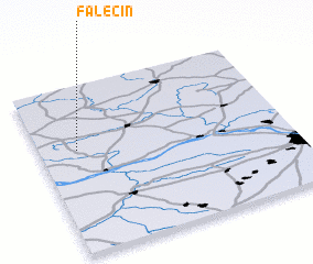 Places with similar names to Falęcin, Poland ::
Disclaimer :: Information on this page comes without warranty of any kind |
||
|
Where is Falęcin? Elevation and coordinates ::
Latitude (lat): 52°37'0"N Longitude (lon): 20°9'0"E
Elevation (approx.): 116m (map arrows pan, magnifying glasses zoom) |
||
|
Visiting Falęcin? Hotel/Accommodation ::
Book a hotel in Falęcin Travel Guide ::
Buy a travel guide for Poland rental cars ::
car rental offers GPS waypoint ::
download a GPX waypoint (PoI) of Falęcin for your GPS receiver
|
||