|
search place name
|
||
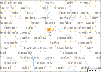
Gaj (Poland)Gaj is a town in Poland. An overview map of the region around Gaj is displayed below.
regional and 3d topo map of Gaj, Poland ::
Gaj airports ::
The nearest airport is WAW - Warsaw Okecie, located 94.6 km north east of Gaj.
Other airports nearby include KTW - Katowice Pyrzowice (149.8 km south), KRK - Krakow Balice (186.0 km south), Nearby towns ::
Białkowice (1.1km west) //
Przanówka (1.9km north) //
Witkowice (1.9km north) //
Przanowice (1.9km south) //
Różyca (2.2km south east) //
Bogdanka (3.7km north) //
Gałkówek Kolonia (2.3km west) //
Kedziorki (3.9km north) //
Kaletnik (3.9km south) //
Koluszki (2.9km north east) //
Gałków Mały (3.0km south west) //
Chrusty Stare (5.7km south) //
Brzeziny (5.7km north) //
Gałków Duży (3.9km south west) //
Żakowice Stare (3.9km south east) //
Żakowice Nowe (3.9km south east) //
Żakowice (3.9km south east) //
Małczew (5.1km north west) //
Chrusty Nowe (6.0km south) //
Będzelin (5.1km south east) //
Tworzyjanki (5.1km north east) //
Borowa (6.0km south) //
Felicjanów Nowy (4.6km east) //
Katarzynów (5.0km east) //
Erazmów (4.9km east) //
Kowalszczyzna (5.0km east) //
Felicjanów (4.9km east) //
Adamów (4.9km west) //
Pogorzałe Ługi (6.5km south east) //
[all distances 'as the bird flies' and approximate]  Places with similar names to Gaj, Poland ::
Disclaimer :: Information on this page comes without warranty of any kind |
||
|
Where is Gaj? Elevation and coordinates ::
Latitude (lat): 51°45'0"N Longitude (lon): 19°46'0"E
Elevation (approx.): 206m (map arrows pan, magnifying glasses zoom) |
||
|
Visiting Gaj? Hotel/Accommodation ::
Book a hotel in Gaj Travel Guide ::
Buy a travel guide for Poland rental cars ::
car rental offers GPS waypoint ::
download a GPX waypoint (PoI) of Gaj for your GPS receiver
|
||