|
search place name
|
||
Gaworzyna (Poland)Gaworzyna is a town in Poland. An overview map of the region around Gaworzyna is displayed below.
regional and 3d topo map of Gaworzyna, Poland ::

Gaworzyna airports ::
The nearest airport is WAW - Warsaw Okecie, located 107.0 km north of Gaworzyna.
Other airports nearby include RZE - Rzeszow Jasionka (135.6 km south east), KRK - Krakow Balice (162.2 km south west), Nearby towns ::
Płudnica (2.2km north west) //
Walentynów (2.3km east) //
Podsuliszka (3.7km north) //
Starosiedlice (3.7km south) //
Krzyżanowice (3.0km south east) //
Suliszka (3.0km north west) //
Pakosław (3.0km south west) //
Alojzów (3.9km north east) //
Antoniów (5.7km north) //
Kolonia Jedlanka (3.9km south east) //
Iłża (6.0km south east) //
Bujak (5.1km north east) //
Łączany (5.1km north west) //
Modrzejowice (6.0km north east) //
Podgórki (6.0km north west) //
Wilczna (7.4km north) //
Kajetanów (5.0km east) //
Jedlanka Stara (5.0km east) //
Pomorzany (5.0km west) //
Zalesie (5.9km north east) //
Błaziny (7.8km south) //
Seredzice (7.8km south) //
Zalesice (7.2km north west) //
Bukowiec (8.7km north west) //
[all distances 'as the bird flies' and approximate] 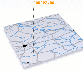 Places with similar names to Gaworzyna, Poland ::
Disclaimer :: Information on this page comes without warranty of any kind |
||
|
Where is Gaworzyna? Elevation and coordinates ::
Latitude (lat): 51°13'0"N Longitude (lon): 21°13'0"E
Elevation (approx.): 186m (map arrows pan, magnifying glasses zoom) |
||
|
Visiting Gaworzyna? Hotel/Accommodation ::
Book a hotel in Gaworzyna Travel Guide ::
Buy a travel guide for Poland rental cars ::
car rental offers GPS waypoint ::
download a GPX waypoint (PoI) of Gaworzyna for your GPS receiver
|
||