|
search place name
|
||
Gutkowice (Poland)Gutkowice is a town in Poland. An overview map of the region around Gutkowice is displayed below.
regional and 3d topo map of Gutkowice, Poland ::

Gutkowice airports ::
The nearest airport is WAW - Warsaw Okecie, located 75.2 km north east of Gutkowice.
Other airports nearby include KTW - Katowice Pyrzowice (160.0 km south west), KRK - Krakow Balice (189.1 km south), RZE - Rzeszow Jasionka (229.1 km south east), Nearby towns ::
Głuchów (1.9km north) //
Wola Naropińska (1.9km south) //
Józefin (2.2km south west) //
Branik (2.2km south west) //
Miłochniewice (2.2km north east) //
Łochów (2.2km south east) //
Feliksów (3.7km south) //
Kolonia Głuchów (3.9km north) //
Adamów (2.9km north west) //
Prusy (3.9km north) //
Kopiec A (2.9km south west) //
Kopiec (2.9km south west) //
Wysokienice Pod Borem (2.9km north east) //
Łochówek (4.4km south west) //
Kopiec Włościański (4.4km south west) //
Naropna (4.4km south west) //
Czechowice (4.4km south west) //
Teklin (4.4km south east) //
Władysławów (3.4km west) //
Gaworków (5.7km south) //
Celigów (5.7km north) //
Białynin-Podbór (5.1km north west) //
Jasień (5.1km north east) //
Wysokienice (5.1km north east) //
Radoryż Smolany (5.1km north east) //
Kochanów (4.6km west) //
Złota (4.6km east) //
Michowice (7.5km north) //
Bukowiec (7.5km south) //
[all distances 'as the bird flies' and approximate] 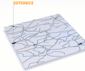 Places with similar names to Gutkowice, Poland ::
// Gotkowice (PL)
Disclaimer :: Information on this page comes without warranty of any kind |
||
|
Where is Gutkowice? Elevation and coordinates ::
Latitude (lat): 51°46'0"N Longitude (lon): 20°5'0"E
Elevation (approx.): 173m (map arrows pan, magnifying glasses zoom) |
||
|
Visiting Gutkowice? Hotel/Accommodation ::
Book a hotel in Gutkowice Travel Guide ::
Buy a travel guide for Poland rental cars ::
car rental offers GPS waypoint ::
download a GPX waypoint (PoI) of Gutkowice for your GPS receiver
|
||