|
search place name
|
||
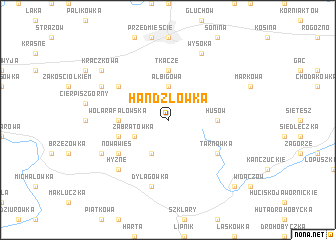
Handzlówka (Poland)Handzlówka is a town in Poland. An overview map of the region around Handzlówka is displayed below.
regional and 3d topo map of Handzlówka, Poland ::
Handzlówka airports ::
The nearest airport is RZE - Rzeszow Jasionka, located 20.8 km north west of Handzlówka.
Other airports nearby include LWO - Lvov Lviv Intl (125.2 km east), KSC - Kosice (163.6 km south west), TAT - Poprad Tatry (176.2 km south west), Nearby towns ::
Albigowa (3.7km north) //
Grzegorzówka (3.9km south) //
Zabratówka (3.0km south west) //
Husów (3.6km east) //
Wola Rafałowska (3.6km west) //
Tkacze (5.6km north) //
Błędowa Tyczyńska (4.0km south west) //
Tarnawka (5.2km south east) //
Nowa Wieś (5.2km south west) //
Cierpisz Dolny (5.1km north west) //
Dylągówka (7.5km south) //
Hyżne (6.6km south west) //
Borówki (6.0km south west) //
Cierpisz (6.0km north west) //
Wysoka (7.8km north) //
Kraczkowa (7.3km north west) //
Hadle Szklarskie (8.8km south east) //
[all distances 'as the bird flies' and approximate] 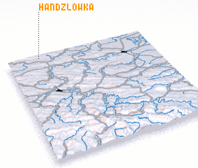 Places with similar names to Handzlówka, Poland :: Disclaimer :: Information on this page comes without warranty of any kind |
||
|
Where is Handzlówka? Elevation and coordinates ::
Latitude (lat): 49°59'0"N Longitude (lon): 22°14'0"E
Elevation (approx.): 328m (map arrows pan, magnifying glasses zoom) |
||
|
Visiting Handzlówka? Hotel/Accommodation ::
Book a hotel in Handzlówka Travel Guide ::
Buy a travel guide for Poland rental cars ::
car rental offers GPS waypoint ::
download a GPX waypoint (PoI) of Handzlówka for your GPS receiver
|
||