|
search place name
|
||
Huta (Poland)Huta is a town in Poland. An overview map of the region around Huta is displayed below.
regional and 3d topo map of Huta, Poland ::

Huta airports ::
The nearest airport is KTW - Katowice Pyrzowice, located 108.6 km south of Huta.
Other airports nearby include WAW - Warsaw Okecie (132.0 km north east), KRK - Krakow Balice (150.5 km south), OSR - Ostrava Mosnov (214.7 km south west), Nearby towns ::
Budków (1.2km east) //
Stradzew (1.9km south) //
Hucisko (2.2km north west) //
Wielopole (2.3km west) //
Gatki (3.7km north) //
Wdowin (3.0km north west) //
Suchcice (3.0km north west) //
Niedyszyna (3.0km south west) //
Żadło (3.0km north east) //
Mzurki (3.0km north east) //
Piekary (3.0km south east) //
Kolonia Wdowin (4.4km north west) //
Mąkolice (4.4km south east) //
Wożniki (3.5km east) //
Postękalice (5.6km south) //
Pólko (3.5km west) //
Krzepczów (5.7km north) //
Krzepczów Stary (5.7km north) //
Zwierzchów (6.0km south west) //
Zaborów (5.1km north east) //
Krzepczów Nowy (6.0km north east) //
Bukowie Górne (4.6km west) //
Rzachta (4.6km east) //
Dziewuliny (7.5km north) //
Bukowie Dolne (5.0km west) //
Boryszów (7.5km north) //
Paulinów (5.0km west) //
Mokracz (7.5km south) //
Janina (7.5km south) //
[all distances 'as the bird flies' and approximate] 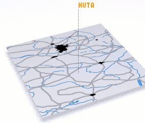 Places with similar names to Huta, Poland ::
Disclaimer :: Information on this page comes without warranty of any kind |
||
|
Where is Huta? Elevation and coordinates ::
Latitude (lat): 51°25'0"N Longitude (lon): 19°29'0"E
Elevation (approx.): 222m (map arrows pan, magnifying glasses zoom) |
||
|
Visiting Huta? Hotel/Accommodation ::
Book a hotel in Huta Travel Guide ::
Buy a travel guide for Poland rental cars ::
car rental offers GPS waypoint ::
download a GPX waypoint (PoI) of Huta for your GPS receiver
|
||