|
search place name
|
||
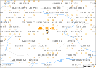
Jajkowice (Poland)Jajkowice is a town in Poland. An overview map of the region around Jajkowice is displayed below.
regional and 3d topo map of Jajkowice, Poland ::
Jajkowice airports ::
The nearest airport is WAW - Warsaw Okecie, located 55.0 km north east of Jajkowice.
Other airports nearby include KTW - Katowice Pyrzowice (175.9 km south west), KRK - Krakow Balice (191.8 km south), RZE - Rzeszow Jasionka (203.6 km south east), Nearby towns ::
Kolonia Kłopoczyn (1.1km west) //
Lipna (1.9km south) //
Kłopoczyn (1.9km south) //
Zaborze (2.2km north east) //
Katarzynów (3.9km north) //
Huta Błędowska (3.9km north) //
Lubania (4.4km south west) //
Wilhelmów (4.4km north east) //
Wężawiec (4.4km south east) //
Promnik (5.6km south) //
Pawłowice (3.4km east) //
Trębaczew (3.4km west) //
Gołosze (5.6km north) //
Skarbkowa (5.7km south) //
Świdrygały (5.7km south) //
Żelazna (5.7km south) //
Ignaców (5.7km north) //
Paprotnia (4.6km west) //
Wólka Gołoska (7.4km north) //
Główczynek (4.6km east) //
Wał (7.4km south) //
Główczyn Towarzystwo (5.0km east) //
Popowice (5.0km east) //
Wólka Gostomska (7.5km south) //
Sacin (6.5km south west) //
Błędów Nowy (6.5km north east) //
Szczuki Duże (5.9km north west) //
Szczuki (5.9km north west) //
Celinów (5.9km north west) //
[all distances 'as the bird flies' and approximate] 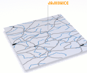 Places with similar names to Jajkowice, Poland ::
// Jejkowice (PL)
Disclaimer :: Information on this page comes without warranty of any kind |
||
|
Where is Jajkowice? Elevation and coordinates ::
Latitude (lat): 51°43'0"N Longitude (lon): 20°38'0"E
Elevation (approx.): 169m (map arrows pan, magnifying glasses zoom) |
||
|
Visiting Jajkowice? Hotel/Accommodation ::
Book a hotel in Jajkowice Travel Guide ::
Buy a travel guide for Poland rental cars ::
car rental offers GPS waypoint ::
download a GPX waypoint (PoI) of Jajkowice for your GPS receiver
|
||