|
search place name
|
||
Jaworze (Poland)Jaworze is a town in Poland. An overview map of the region around Jaworze is displayed below.
regional and 3d topo map of Jaworze, Poland ::

Jaworze airports ::
The nearest airport is OSR - Ostrava Mosnov, located 62.7 km west of Jaworze.
Other airports nearby include KRK - Krakow Balice (66.4 km north east), KTW - Katowice Pyrzowice (75.4 km north), PRV - Prerov (120.3 km west), TAT - Poprad Tatry (122.8 km south east), Nearby towns ::
Wapienica (2.2km north east) //
Jasienica (4.4km north west) //
Biery (3.6km west) //
Świętoszówka (3.6km west) //
Aleksandrowice (4.0km north east) //
Jasionki (4.0km south west) //
Międzyrzecze Górne (5.7km north) //
Stare Bielsko (5.2km north east) //
Kamienica (4.8km east) //
Międzyrzecze Dolne (7.4km north) //
Bielsko-Biała (5.1km east) //
Mazańcowice (7.5km north) //
Łazy (6.1km north west) //
Świrkowice (8.2km north east) //
Rudzica (7.3km north west) //
Landek (8.8km north west) //
[all distances 'as the bird flies' and approximate] 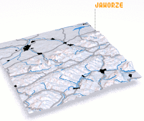
Disclaimer :: Information on this page comes without warranty of any kind |
||
|
Where is Jaworze? Elevation and coordinates ::
Latitude (lat): 49°48'0"N Longitude (lon): 18°58'0"E
Elevation (approx.): 378m (map arrows pan, magnifying glasses zoom) |
||
|
Visiting Jaworze? Hotel/Accommodation ::
Book a hotel in Jaworze Travel Guide ::
Buy a travel guide for Poland rental cars ::
car rental offers GPS waypoint ::
download a GPX waypoint (PoI) of Jaworze for your GPS receiver
|
||