|
search place name
|
||
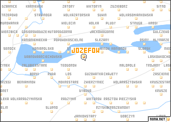
Józefów (Poland)Józefów is a town in Poland. An overview map of the region around Józefów is displayed below.
regional and 3d topo map of Józefów, Poland ::
Józefów airports ::
The nearest airport is WAW - Warsaw Okecie, located 40.9 km south west of Józefów.
Nearby towns ::
Czarnów (1.9km north) //
Stasiopole (2.2km north west) //
Guzowatka (3.9km south) //
Ludwinów (2.9km north east) //
Kowalicha (2.9km north east) //
Teodorów (2.9km south west) //
Kuligów (2.9km north west) //
Sokołówek (2.9km south west) //
Jackowo Dolne (4.3km north east) //
Ślężany (4.3km north east) //
Popowo Kościelne (4.3km north west) //
Popowo (4.3km north west) //
Łoś (4.3km south west) //
Zawady (5.6km south) //
Kołaków (5.7km south) //
Zwierzyniec (5.7km south) //
Popowo Piaski (3.9km north west) //
Jackowo Górne (6.0km north) //
Barcice (5.0km north east) //
Chajęty (5.0km south east) //
Mokre Stare (6.0km south) //
Mokre (6.0km south) //
Dybów (7.4km south) //
Dybów A (7.4km south) //
Marianów (4.9km east) //
Wólka (7.5km north) //
Załubice Nowe (4.9km west) //
Huta Podgórna (6.5km north west) //
Mokre Nowe (6.5km south west) //
[all distances 'as the bird flies' and approximate]  Places with similar names to Józefów, Poland ::
Disclaimer :: Information on this page comes without warranty of any kind |
||
|
Where is Józefów? Elevation and coordinates ::
Latitude (lat): 52°30'0"N Longitude (lon): 21°13'0"E
Elevation (approx.): 78m (map arrows pan, magnifying glasses zoom) |
||
|
Visiting Józefów? Hotel/Accommodation ::
Book a hotel in Józefów Travel Guide ::
Buy a travel guide for Poland rental cars ::
car rental offers GPS waypoint ::
download a GPX waypoint (PoI) of Józefów for your GPS receiver
|
||