|
search place name
|
||
Kołbiel (Poland)Kołbiel is a town in Poland. An overview map of the region around Kołbiel is displayed below.
regional and 3d topo map of Kołbiel, Poland ::

Kołbiel airports ::
The nearest airport is WAW - Warsaw Okecie, located 37.0 km west of Kołbiel.
Other airports nearby include RZE - Rzeszow Jasionka (220.9 km south), KRK - Krakow Balice (251.2 km south west), Nearby towns ::
Gadka (1.9km south) //
Sępochów (2.2km north west) //
Rudno (2.2km north east) //
Władzin (2.3km east) //
Stara Wieś (2.9km south west) //
Człekowka (2.9km south west) //
Wola Sufczyńska (2.9km south east) //
Teresin (4.4km north east) //
Chrosna (4.4km south west) //
Zabieżki (5.6km south) //
Gózd (3.4km west) //
Rudzienko (5.6km north) //
Kąty (5.7km south) //
Chełst (5.0km north east) //
Siwianka (5.0km north west) //
Dobrzyniec (6.0km north) //
Lubice (6.0km south) //
Sufczyn (5.0km south east) //
Karpiska (5.0km south west) //
Józefów (7.4km north) //
Podgórzno (4.6km east) //
Utrata (4.9km east) //
Iłowiec (6.5km north east) //
Rzakta (7.8km north) //
Glinianka (8.2km north west) //
Grzebowilk (7.2km north east) //
Ponurzyca (8.7km south west) //
[all distances 'as the bird flies' and approximate] 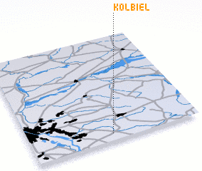 Places with similar names to Kołbiel, Poland ::
Disclaimer :: Information on this page comes without warranty of any kind |
||
|
Where is Kołbiel? Elevation and coordinates ::
Latitude (lat): 52°4'0"N Longitude (lon): 21°29'0"E
Elevation (approx.): 117m (map arrows pan, magnifying glasses zoom) |
||
|
Visiting Kołbiel? Hotel/Accommodation ::
Book a hotel in Kołbiel Travel Guide ::
Buy a travel guide for Poland rental cars ::
car rental offers GPS waypoint ::
download a GPX waypoint (PoI) of Kołbiel for your GPS receiver
|
||