|
search place name
|
||
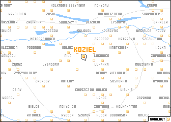
Kozieł (Poland)Kozieł is a town in Poland. An overview map of the region around Kozieł is displayed below.
regional and 3d topo map of Kozieł, Poland ::
Kozieł airports ::
The nearest airport is WAW - Warsaw Okecie, located 110.3 km north west of Kozieł.
Other airports nearby include RZE - Rzeszow Jasionka (158.9 km south), LWO - Lvov Lviv Intl (228.1 km south east), Nearby towns ::
Huta (1.2km east) //
Karczunek (1.2km east) //
Śniadówka (2.2km south west) //
Wola Czołnowska (2.2km north west) //
Kolonia Nowomichowska (2.2km north east) //
Niwa (2.3km west) //
Łukawica (2.3km east) //
Łukawka (3.0km south east) //
Czołna (3.0km north west) //
Dębczyna (3.9km north) //
Dębiny (4.4km south east) //
Zagoźdź (4.4km north east) //
Składów (5.6km north) //
Kolonia Czołna (3.5km west) //
Kotliny (6.0km south west) //
Baranów (5.1km north west) //
Meszno (5.1km north east) //
Choszczów (7.4km south) //
Bronisławka (7.4km south) //
Marianka (7.5km south) //
Łysa Góra (5.0km west) //
Miastkówek (5.0km east) //
Blizocin (7.5km north) //
Kruszyna (6.5km north east) //
Wolica (7.8km south) //
Sobieszyn (7.8km north) //
Wielkolas (5.9km south east) //
Izabelmont (8.2km south east) //
Drążgów (7.2km north west) //
[all distances 'as the bird flies' and approximate]  Places with similar names to Kozieł, Poland ::
Disclaimer :: Information on this page comes without warranty of any kind |
||
|
Where is Kozieł? Elevation and coordinates ::
Latitude (lat): 51°32'0"N Longitude (lon): 22°12'0"E
Elevation (approx.): 161m (map arrows pan, magnifying glasses zoom) |
||
|
Visiting Kozieł? Hotel/Accommodation ::
Book a hotel in Kozieł Travel Guide ::
Buy a travel guide for Poland rental cars ::
car rental offers GPS waypoint ::
download a GPX waypoint (PoI) of Kozieł for your GPS receiver
|
||