|
search place name
|
||
Kułaki (Poland)Kułaki is a town in Poland. An overview map of the region around Kułaki is displayed below.
regional and 3d topo map of Kułaki, Poland ::

Kułaki airports ::
The nearest airport is WAW - Warsaw Okecie, located 124.3 km south west of Kułaki.
Nearby towns ::
Winna-Poświętne (1.9km north) //
Winna Chroły (1.9km north) //
Radziszewo Stare (1.1km east) //
Trzaski (2.2km north east) //
Radziszewo Króle (2.2km south east) //
Malec (2.2km south west) //
Winna Wypychy (2.9km north west) //
Radziszewo Sobiechowo (2.9km south east) //
Koce Piskuły (3.9km north) //
Koce Basie (3.9km north) //
Bujenka (4.3km north west) //
Antonin (3.8km north west) //
Skórzec (5.7km south) //
Radziszewo (3.8km south east) //
Koce Schaby (5.0km north east) //
Pobikry (5.0km south east) //
Przybyszyn (5.0km south west) //
Radziszewo Sieńczuch (4.5km east) //
Łempice (4.9km east) //
Moczydły Pszczółki (7.5km south) //
Czarkówka Mała (7.5km south) //
Żery Bystre (6.5km south east) //
Krynki Jarki (6.5km south east) //
Krynki Miklasy (6.5km south east) //
Poniaty (6.5km south west) //
Moczydły Kukiełki (7.7km south) //
Moczydły Dubiny (7.7km south) //
Kosiorki (5.8km south west) //
Gródek (8.1km north west) //
[all distances 'as the bird flies' and approximate] 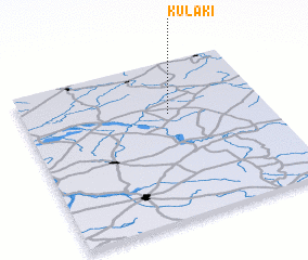 Places with similar names to Kułaki, Poland ::
Disclaimer :: Information on this page comes without warranty of any kind |
||
|
Where is Kułaki? Elevation and coordinates ::
Latitude (lat): 52°40'0"N Longitude (lon): 22°36'0"E
Elevation (approx.): 129m (map arrows pan, magnifying glasses zoom) |
||
|
Visiting Kułaki? Hotel/Accommodation ::
Book a hotel in Kułaki Travel Guide ::
Buy a travel guide for Poland rental cars ::
car rental offers GPS waypoint ::
download a GPX waypoint (PoI) of Kułaki for your GPS receiver
|
||