|
search place name
|
||
Linin (Poland)Linin is a town in Poland. An overview map of the region around Linin is displayed below.
regional and 3d topo map of Linin, Poland ::

Linin airports ::
The nearest airport is WAW - Warsaw Okecie, located 28.2 km north west of Linin.
Other airports nearby include RZE - Rzeszow Jasionka (212.9 km south), KRK - Krakow Balice (230.2 km south west), Nearby towns ::
Wincentów (1.1km west) //
Karolina (1.9km north) //
Dębówka (2.2km north west) //
Pęcław (2.2km south east) //
Jurandów (3.7km south) //
Czaplinek (2.3km west) //
Czaplinek Dworski (3.9km north) //
Marianki (3.9km north) //
Sobików (2.9km north west) //
Grabina (2.9km south west) //
Cedrowice (4.4km north west) //
Machcin (4.4km south west) //
Stefanów (4.4km north east) //
Podosowa (4.4km south east) //
Minkowlas (5.6km north) //
Tomice (5.6km north) //
Czersk (3.4km east) //
Kąty (5.7km north) //
Zalesie (5.7km south) //
Obręb (3.9km north west) //
Podgóra (3.9km south east) //
Grabice (3.9km south west) //
Rososzka (5.7km south) //
Góra Kalwaria (5.0km north east) //
Weteranów (5.0km north east) //
Potycz (5.0km south east) //
Coniew (5.0km south east) //
Jakubowizna (5.0km south west) //
Moczydłow (6.0km north) //
[all distances 'as the bird flies' and approximate] 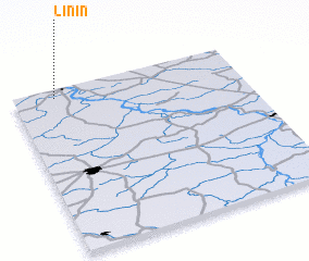 Places with similar names to Linin, Poland ::
Disclaimer :: Information on this page comes without warranty of any kind |
||
|
Where is Linin? Elevation and coordinates ::
Latitude (lat): 51°57'0"N Longitude (lon): 21°11'0"E
Elevation (approx.): 109m (map arrows pan, magnifying glasses zoom) |
||
|
Visiting Linin? Hotel/Accommodation ::
Book a hotel in Linin Travel Guide ::
Buy a travel guide for Poland rental cars ::
car rental offers GPS waypoint ::
download a GPX waypoint (PoI) of Linin for your GPS receiver
|
||