|
search place name
|
||
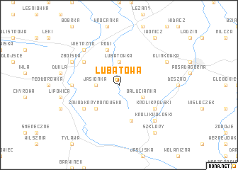
Lubatowa (Poland)Lubatowa is a town in Poland. An overview map of the region around Lubatowa is displayed below.
regional and 3d topo map of Lubatowa, Poland ::
Lubatowa airports ::
The nearest airport is RZE - Rzeszow Jasionka, located 64.9 km north of Lubatowa.
Other airports nearby include KSC - Kosice (105.8 km south), TAT - Poprad Tatry (122.9 km south west), KRK - Krakow Balice (154.2 km north west), SUJ - Satu Mare (221.3 km south), Nearby towns ::
Lubatówka (3.7km north) //
Jasionka (2.4km west) //
Bałucianka (3.0km south east) //
Iwonicz-Zdrój (3.0km north east) //
Zawadka Rymanowska (4.4km south west) //
Kamionka (5.7km south) //
Rogi (5.7km north) //
Trzciana (5.2km south west) //
Królik Polski (5.2km south east) //
Równe (5.2km north west) //
Cergowa (4.8km west) //
Królik Wołoski (6.6km south east) //
Wietrzno (6.6km north west) //
Klimkówka (6.1km north east) //
Zboiska (6.1km north west) //
Szklary (8.2km south east) //
Iwonicz (8.2km north east) //
[all distances 'as the bird flies' and approximate]  Places with similar names to Lubatowa, Poland ::
Disclaimer :: Information on this page comes without warranty of any kind |
||
|
Where is Lubatowa? Elevation and coordinates ::
Latitude (lat): 49°33'0"N Longitude (lon): 21°46'0"E
Elevation (approx.): 469m (map arrows pan, magnifying glasses zoom) |
||
|
Visiting Lubatowa? Hotel/Accommodation ::
Book a hotel in Lubatowa Travel Guide ::
Buy a travel guide for Poland rental cars ::
car rental offers GPS waypoint ::
download a GPX waypoint (PoI) of Lubatowa for your GPS receiver
|
||