|
search place name
|
||
Lubotyń Stary (Poland)Lubotyń Stary is a town in Poland. An overview map of the region around Lubotyń Stary is displayed below.
regional and 3d topo map of Lubotyń Stary, Poland ::

Lubotyń Stary airports ::
The nearest airport is WAW - Warsaw Okecie, located 106.2 km south west of Lubotyń Stary.
Other airports nearby include KGD - Kaliningrad Khrabrovo (236.7 km north), Nearby towns ::
Lubotyń (1.9km north) //
Klimonty (1.1km west) //
Gumowo (1.1km east) //
Lubotyń Parcele (2.2km north east) //
Lubotyń Morgi (3.7km north) //
Kosewo (2.2km west) //
Lubotyń Łazy (3.7km north) //
Lubotyń Włóki (2.9km north west) //
Grądziki (3.9km south) //
Podbiele (2.9km south east) //
Budziszki (4.3km north west) //
Pałapus (5.6km south) //
Podbielsko (3.4km east) //
Tyszki Pomiany (5.7km north) //
Rogowo (3.8km north west) //
Gawki (3.8km north east) //
Gniazdowo (3.8km north west) //
Pałapus Włośćiański (5.7km south) //
Pałapus Szlachecki (5.7km south) //
Rząśnik (5.0km north east) //
Żochowo (5.0km south east) //
Sulęcin (5.0km south west) //
Tyszki Piotrowo (7.4km north) //
Stryjki Zaręby (4.5km east) //
Tyszki Gostery (7.5km north) //
Tyszki (7.5km north) //
Rogowo Stare (4.8km north west) //
Rogowo Folwark (4.8km north west) //
Tyszki Andrzejki (7.5km north) //
[all distances 'as the bird flies' and approximate] 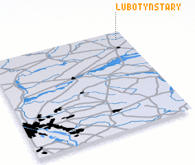 Places with similar names to Lubotyń Stary, Poland :: Disclaimer :: Information on this page comes without warranty of any kind |
||
|
Where is Lubotyń Stary? Elevation and coordinates ::
Latitude (lat): 52°55'0"N Longitude (lon): 21°56'0"E
Elevation (approx.): 112m (map arrows pan, magnifying glasses zoom) |
||
|
Visiting Lubotyń Stary? Hotel/Accommodation ::
Book a hotel in Lubotyń Stary Travel Guide ::
Buy a travel guide for Poland rental cars ::
car rental offers GPS waypoint ::
download a GPX waypoint (PoI) of Lubotyń Stary for your GPS receiver
|
||