|
search place name
|
||
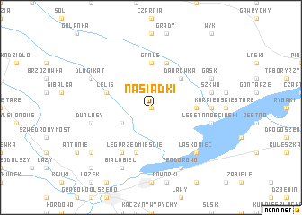
Nasiadki (Poland)Nasiadki is a town in Poland. An overview map of the region around Nasiadki is displayed below.
regional and 3d topo map of Nasiadki, Poland ::
Nasiadki airports ::
The nearest airport is WAW - Warsaw Okecie, located 121.5 km south of Nasiadki.
Other airports nearby include KGD - Kaliningrad Khrabrovo (201.5 km north), Nearby towns ::
Szafarczyska (0.0km north) //
Przewrotna Góra (2.9km south west) //
Dąbrówka (4.3km north east) //
Grale (5.6km north) //
Kurpiewskie Nowe (3.3km east) //
Płoszyce (5.7km north) //
Lelis (3.8km north west) //
Łęg Przedmieście (5.7km south) //
Gnaty (6.0km south) //
Kurpiewskie (4.4km east) //
Łęg Starościński (4.8km south east) //
Szkwa (4.8km north east) //
Durlasy (4.8km south west) //
Laskowiec (6.5km south east) //
Teodorowo (7.7km south) //
Białobiel (7.7km south) //
Gąski (5.8km north east) //
Bienduszka (5.8km north east) //
Długi Kąt (5.8km north west) //
Siemnocha (7.1km south west) //
Zabrodzie (8.6km south west) //
[all distances 'as the bird flies' and approximate]  Places with similar names to Nasiadki, Poland ::
Disclaimer :: Information on this page comes without warranty of any kind |
||
|
Where is Nasiadki? Elevation and coordinates ::
Latitude (lat): 53°11'0"N Longitude (lon): 21°37'0"E
Elevation (approx.): 102m (map arrows pan, magnifying glasses zoom) |
||
|
Visiting Nasiadki? Hotel/Accommodation ::
Book a hotel in Nasiadki Travel Guide ::
Buy a travel guide for Poland rental cars ::
car rental offers GPS waypoint ::
download a GPX waypoint (PoI) of Nasiadki for your GPS receiver
|
||