|
search place name
|
||
Odnoga (Poland)Odnoga is a town in Poland. An overview map of the region around Odnoga is displayed below.
regional and 3d topo map of Odnoga, Poland ::
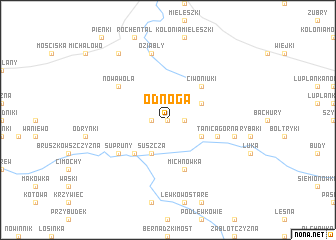
Nearby towns ::
Odnoga Kuźmy (0.0km north) //
Odnoga Saki (0.0km north) //
Odnoga Denisowo (0.0km north) //
Planty (1.1km west) //
Odnoga Sacharki (1.1km east) //
Suszcza (3.9km south) //
Juszkowy Gród (2.9km north east) //
Tanica Dolna (2.9km south east) //
Słobódka (2.9km south east) //
Bindziuha (4.3km south west) //
Ciwoniuki (4.3km north east) //
Eliaszuki (5.7km south) //
Michnówka (5.7km south) //
Tanica Górna (3.8km south east) //
Nowa Wola (5.0km north west) //
Supruny (5.0km south west) //
Oziabły (7.5km north) //
Bondary (4.8km south east) //
Kobylanka (8.1km north west) //
[all distances 'as the bird flies' and approximate] 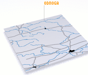 Places with similar names to Odnoga, Poland ::
Disclaimer :: Information on this page comes without warranty of any kind |
||
|
Where is Odnoga? Elevation and coordinates ::
Latitude (lat): 52°58'0"N Longitude (lon): 23°41'0"E
Elevation (approx.): 152m (map arrows pan, magnifying glasses zoom) |
||
|
Visiting Odnoga? Hotel/Accommodation ::
Book a hotel in Odnoga Travel Guide ::
Buy a travel guide for Poland rental cars ::
car rental offers GPS waypoint ::
download a GPX waypoint (PoI) of Odnoga for your GPS receiver
|
||