|
search place name
|
||
Olsza (Poland)Olsza is a town in Poland. An overview map of the region around Olsza is displayed below.
regional and 3d topo map of Olsza, Poland ::

Olsza airports ::
The nearest airport is WAW - Warsaw Okecie, located 86.0 km north east of Olsza.
Other airports nearby include KTW - Katowice Pyrzowice (158.8 km south), KRK - Krakow Balice (193.5 km south), Nearby towns ::
Rogów (0.0km north) //
Kolonia Olsza (1.1km east) //
Michałów (1.1km west) //
Mroga Dolna (2.2km north west) //
Józefów (2.3km east) //
Rozworzyn (2.3km west) //
Bronowice (2.9km south west) //
Przecław (2.9km south west) //
Jasień (3.9km north) //
Wągry (3.9km south) //
Bełdówka (3.9km south) //
Stefanów (4.4km north east) //
Tworzyjanki (4.4km south west) //
Jeziorko (5.6km south) //
Marianów-Rogowski (3.4km east) //
Zacywilki (5.6km north) //
Szymaniszki (3.9km north west) //
Henryków (3.9km north west) //
Erazmów (5.7km south) //
Felicjanów (5.7km south) //
Kołacinek (5.7km north) //
Wierzchy Stare (6.0km south) //
Przyłęk Mały (5.1km north east) //
Kółacin (6.0km north) //
Olszewo (5.1km south east) //
Kotulin (7.5km north) //
Długie (7.5km south) //
Stefanów (7.5km south) //
Felicjanów Nowy (7.5km south) //
[all distances 'as the bird flies' and approximate] 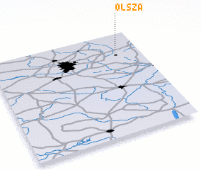 Places with similar names to Olsza, Poland ::
Disclaimer :: Information on this page comes without warranty of any kind |
||
|
Where is Olsza? Elevation and coordinates ::
Latitude (lat): 51°49'0"N Longitude (lon): 19°51'0"E
Elevation (approx.): 203m (map arrows pan, magnifying glasses zoom) |
||
|
Visiting Olsza? Hotel/Accommodation ::
Book a hotel in Olsza Travel Guide ::
Buy a travel guide for Poland rental cars ::
car rental offers GPS waypoint ::
download a GPX waypoint (PoI) of Olsza for your GPS receiver
|
||