|
search place name
|
||
Orzeszków (Poland)Orzeszków is a town in Poland. An overview map of the region around Orzeszków is displayed below.
regional and 3d topo map of Orzeszków, Poland ::

Orzeszków airports ::
The nearest airport is POZ - Poznan Lawica, located 142.2 km west of Orzeszków.
Other airports nearby include WRO - Wroclaw Strachowice (167.2 km south west), KTW - Katowice Pyrzowice (172.7 km south), KRK - Krakow Balice (226.5 km south), Nearby towns ::
Czepów Średni (1.9km north) //
Kolonia Orzeszków (1.9km south) //
Czepów Górny (2.2km north east) //
Brzeziny (2.2km south east) //
Kolonia Wielenin (2.3km east) //
Skotniki (2.9km north west) //
Czepów Dolny (3.9km north) //
Ostrosko (2.9km south west) //
Kościelnica (3.9km south) //
Rożniatów (4.4km north east) //
Wilamów (4.4km north west) //
Felicjanów (4.4km south east) //
Kuczki (3.4km west) //
Wielenin (3.4km east) //
Uniejów (5.6km south) //
Góry (3.9km north west) //
Kozanki Wielkie (3.9km north east) //
Chwalborzyce (6.0km north) //
Domanin (6.0km north) //
Brzozówka (5.0km north west) //
Wola Przedmiejska (6.0km south) //
Pągów (4.6km east) //
Cichmiana (7.5km north) //
Zaborów (4.9km east) //
Spicymierz (7.5km south) //
Lekaszyn (6.5km north west) //
Człopy (6.5km south west) //
Dąbie (7.8km north) //
Chruścin (7.8km north) //
[all distances 'as the bird flies' and approximate] 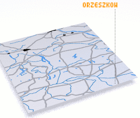
Disclaimer :: Information on this page comes without warranty of any kind |
||
|
Where is Orzeszków? Elevation and coordinates ::
Latitude (lat): 52°1'0"N Longitude (lon): 18°48'0"E
Elevation (approx.): 102m (map arrows pan, magnifying glasses zoom) |
||
|
Visiting Orzeszków? Hotel/Accommodation ::
Book a hotel in Orzeszków Travel Guide ::
Buy a travel guide for Poland rental cars ::
car rental offers GPS waypoint ::
download a GPX waypoint (PoI) of Orzeszków for your GPS receiver
|
||