|
search place name
|
||
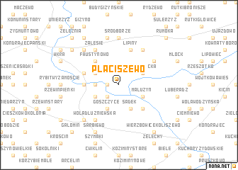
Płaciszewo (Poland)Płaciszewo is a town in Poland. An overview map of the region around Płaciszewo is displayed below.
regional and 3d topo map of Płaciszewo, Poland ::
Płaciszewo airports ::
The nearest airport is WAW - Warsaw Okecie, located 77.8 km south east of Płaciszewo.
Other airports nearby include GDN - Gdansk Lecha Walesy (219.7 km north west), Nearby towns ::
Płaciszewko (1.1km west) //
Goszczyce Młyńskie (2.2km south west) //
Dziektarzewo (2.2km west) //
Ogonowo (2.9km north west) //
Goszczyce Podleśne (2.9km south west) //
Goszczyce Poświętne (2.9km south west) //
Wola Młocka (2.9km north east) //
Goszczyce (3.9km south) //
Budy Radzymińskie (3.9km south) //
Goszczyce Średnie (3.9km south) //
Malużyn (2.9km south east) //
Sadek (3.9km south) //
Faustynowo (4.3km north west) //
Kępa (4.3km south east) //
Ogonowo (3.4km west) //
Luszewo (3.8km north west) //
Lipiny (5.7km north) //
Zalesie (6.0km north) //
Brody Młockie (5.0km north east) //
Wola Dłużniewska (6.0km south) //
Budy Rumockie (6.0km north) //
Sródborze (7.4km north) //
Dukt (7.4km north) //
Krusz (7.5km north) //
Wólka Garwarska (6.5km north west) //
Dłużniewo (6.5km south west) //
Sarbiewo (7.7km south) //
Juliszewo (8.1km north west) //
Nowy Garwarz (7.1km north west) //
[all distances 'as the bird flies' and approximate]  Places with similar names to Płaciszewo, Poland :: Disclaimer :: Information on this page comes without warranty of any kind |
||
|
Where is Płaciszewo? Elevation and coordinates ::
Latitude (lat): 52°46'0"N Longitude (lon): 20°23'0"E
Elevation (approx.): 100m (map arrows pan, magnifying glasses zoom) |
||
|
Visiting Płaciszewo? Hotel/Accommodation ::
Book a hotel in Płaciszewo Travel Guide ::
Buy a travel guide for Poland rental cars ::
car rental offers GPS waypoint ::
download a GPX waypoint (PoI) of Płaciszewo for your GPS receiver
|
||