|
search place name
|
||
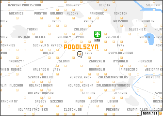
Podolszyn (Poland)Podolszyn is a town in Poland. An overview map of the region around Podolszyn is displayed below.
regional and 3d topo map of Podolszyn, Poland ::
nearby GPS traces from timatio ::
Podolszyn airports ::
The nearest airport is WAW - Warsaw Okecie, located 5.9 km north east of Podolszyn.
Other airports nearby include KTW - Katowice Pyrzowice (223.8 km south west), Nearby towns ::
Laszczki (1.1km west) //
Łady (1.1km east) //
Janczewice (1.9km south) //
Falenty Duże (2.2km north west) //
Jaworowa (2.2km north east) //
Rybie (3.7km north) //
Paluch (3.9km north) //
Raszyn (3.9km north) //
Słomin (2.9km south west) //
Dawidy (2.9km north east) //
Zgorzała (2.9km south east) //
Lesznowola (3.9km south) //
Puchały (4.3km north west) //
Michałowice (4.3km north west) //
Nowa Wola (4.4km south east) //
Załuski (5.6km north) //
Sękocin Nowy (3.4km west) //
Władysławów (5.6km south) //
Opacz (5.7km north) //
Kolonia Opacz (5.7km north) //
Opacz Duża (5.7km north) //
Wypędy (3.9km north west) //
Jeziorki Polskie (3.9km north east) //
Sękocin Stary (3.9km south west) //
Gorzkiewki (5.0km north east) //
Opacz Mała (6.0km north) //
Iwiczna (5.0km south east) //
Łazy (5.0km south west) //
Bobrowiec (6.0km south) //
[all distances 'as the bird flies' and approximate] 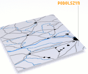 Places with similar names to Podolszyn, Poland ::
Disclaimer :: Information on this page comes without warranty of any kind |
||
|
Where is Podolszyn? Elevation and coordinates ::
Latitude (lat): 52°7'0"N Longitude (lon): 20°56'0"E
Elevation (approx.): 108m (map arrows pan, magnifying glasses zoom) |
||
|
Visiting Podolszyn? Hotel/Accommodation ::
Book a hotel in Podolszyn Travel Guide ::
Buy a travel guide for Poland rental cars ::
car rental offers GPS waypoint ::
download a GPX waypoint (PoI) of Podolszyn for your GPS receiver
|
||