|
search place name
|
||
Rynia (Poland)Rynia is a town in Poland. An overview map of the region around Rynia is displayed below.
regional and 3d topo map of Rynia, Poland ::

Rynia airports ::
The nearest airport is WAW - Warsaw Okecie, located 51.7 km south west of Rynia.
Nearby towns ::
Głęboczyca (1.9km south) //
Ruda Czernik (3.7km north) //
Nowa Rynia (2.3km east) //
Wólka Kokosia (3.7km south) //
Ruda Pniewnik (2.9km north east) //
Dobre (4.3km south east) //
Kąty Flakowizna (3.4km west) //
Zofinin (5.6km north) //
Kąty Czernickie (3.4km west) //
Piwki (3.4km east) //
Wiktoria (3.9km north east) //
Czernik (5.7km north) //
Kąty Borucza (3.9km south west) //
Kobylanka (3.9km south east) //
Poręby (5.7km south) //
Strachówka (7.4km north) //
Kąty Miąski (4.9km west) //
Radoszyna (4.9km east) //
Równe (6.5km north west) //
Rozalin (7.8km north) //
Szamocin (5.8km north east) //
Rakowiec (7.8km south) //
Wólka Mlecka (7.8km south) //
Rudzienko (7.8km south) //
Walentów (5.9km south east) //
Annopol (8.2km north east) //
Krawcowizna (7.2km north west) //
Marysin (7.2km north east) //
Osęczyzna (7.2km south west) //
[all distances 'as the bird flies' and approximate] 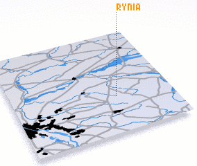 Places with similar names to Rynia, Poland ::
Disclaimer :: Information on this page comes without warranty of any kind |
||
|
Where is Rynia? Elevation and coordinates ::
Latitude (lat): 52°22'0"N Longitude (lon): 21°39'0"E
Elevation (approx.): 130m (map arrows pan, magnifying glasses zoom) |
||
|
Visiting Rynia? Hotel/Accommodation ::
Book a hotel in Rynia Travel Guide ::
Buy a travel guide for Poland rental cars ::
car rental offers GPS waypoint ::
download a GPX waypoint (PoI) of Rynia for your GPS receiver
|
||