|
search place name
|
||
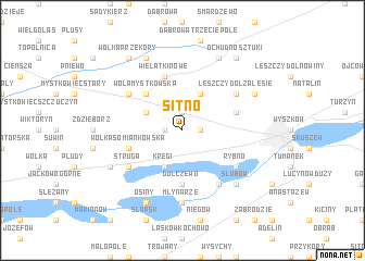
Sitno (Poland)Sitno is a town in Poland. An overview map of the region around Sitno is displayed below.
regional and 3d topo map of Sitno, Poland ::
Sitno airports ::
The nearest airport is WAW - Warsaw Okecie, located 55.5 km south west of Sitno.
Nearby towns ::
Olszanka (1.1km east) //
Ostrowy (1.1km west) //
Łosinno (1.9km north) //
Leszczydół Podwielątki (3.9km north) //
Kręgi (3.9km south) //
Kozłowo (2.9km north west) //
Wola Mystkowska (4.3km north west) //
Gulczewo (5.6km south) //
Wielątki Nowe (5.7km north) //
Leszczydół Stary (3.9km north east) //
Wólka Somiankówska (3.9km south west) //
Leszczydół Zalesie (5.0km north east) //
Leszczydół Pustki (5.0km north east) //
Wielątki Rosochate (5.0km north west) //
Wielątki (5.0km north west) //
Struga (5.0km south west) //
Rybno (5.0km south east) //
Grądy (6.0km south) //
Młynarze (7.4km south) //
Deskurów (6.5km south east) //
Ślubów (6.5km south east) //
Leszczydół (5.8km north east) //
Ochudno Dębniki (7.7km north) //
Somianka (5.8km south west) //
Komorowo (7.7km north) //
Osiny (7.7km south) //
Ochudno (8.1km north east) //
Wólka Przekory (8.1km north west) //
Ochudno Sztuki (8.1km north east) //
[all distances 'as the bird flies' and approximate]  Places with similar names to Sitno, Poland ::
Disclaimer :: Information on this page comes without warranty of any kind |
||
|
Where is Sitno? Elevation and coordinates ::
Latitude (lat): 52°36'0"N Longitude (lon): 21°22'0"E
Elevation (approx.): 97m (map arrows pan, magnifying glasses zoom) |
||
|
Visiting Sitno? Hotel/Accommodation ::
Book a hotel in Sitno Travel Guide ::
Buy a travel guide for Poland rental cars ::
car rental offers GPS waypoint ::
download a GPX waypoint (PoI) of Sitno for your GPS receiver
|
||