|
search place name
|
||
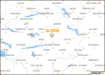
Ślepie (Poland)Ślepie is a town in Poland. An overview map of the region around Ślepie is displayed below.
regional and 3d topo map of Ślepie, Poland ::
Ślepie airports ::
The nearest airport is KGD - Kaliningrad Khrabrovo, located 159.2 km north west of Ślepie.
Other airports nearby include WAW - Warsaw Okecie (224.2 km south west), Nearby towns ::
Gatno Drugie (1.9km south) //
Gatno Dierwsze (3.7km south) //
Kukowo (3.9km north) //
Zajdy (2.9km north west) //
Gąski (2.9km south west) //
Zatyki (3.8km south east) //
Świdry (5.7km south) //
Babki Gąseckie (6.0km south) //
Kijewo (6.0km south) //
Olecko Małe (4.4km east) //
Kukówko (4.4km west) //
Rosochackie (7.5km north) //
Dudki (4.7km north west) //
Olecko (8.1km north east) //
Krokocie (8.1km south west) //
Płociczno (8.1km south west) //
Golubie (8.6km south east) //
[all distances 'as the bird flies' and approximate] 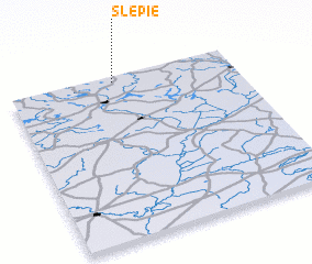 Places with similar names to Ślepie, Poland ::
Disclaimer :: Information on this page comes without warranty of any kind |
||
|
Where is Ślepie? Elevation and coordinates ::
Latitude (lat): 53°58'0"N Longitude (lon): 22°28'0"E
Elevation (approx.): 155m (map arrows pan, magnifying glasses zoom) |
||
|
Visiting Ślepie? Hotel/Accommodation ::
Book a hotel in Ślepie Travel Guide ::
Buy a travel guide for Poland rental cars ::
car rental offers GPS waypoint ::
download a GPX waypoint (PoI) of Ślepie for your GPS receiver
|
||