|
search place name
|
||
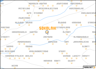
Sokolnik (Poland)Sokolnik is a town in Poland. An overview map of the region around Sokolnik is displayed below.
regional and 3d topo map of Sokolnik, Poland ::
Sokolnik airports ::
The nearest airport is GDN - Gdansk Lecha Walesy, located 79.6 km west of Sokolnik.
Other airports nearby include KGD - Kaliningrad Khrabrovo (98.1 km north east), Nearby towns ::
Nowe Monasterzysko (1.9km north) //
Zastawno (1.9km south) //
Stare Monasterzysko (2.1km north east) //
Warszewo (3.9km south) //
Kwietnik (3.3km west) //
Błudowo (4.9km north east) //
Młynary (4.3km east) //
Płonne (4.7km north east) //
Borzynowo (7.5km south) //
Majewo (5.7km north west) //
Rychnowy (7.7km north) //
Sąpy (5.7km south east) //
Rogowo (7.1km south west) //
Anio łowo (8.1km south west) //
Stegny (8.1km south east) //
Huta (8.6km north west) //
Bądy (8.6km south east) //
[all distances 'as the bird flies' and approximate] 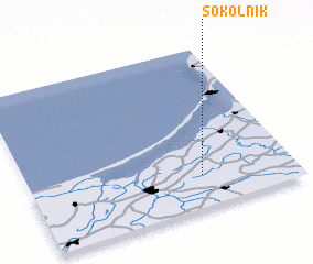 Places with similar names to Sokolnik, Poland ::
// Schölling (AT)
// Schilling (US)
// Schelleneck (DE)
// Schellneck (DE)
// Schlankau (DE)
// Schöllang (DE)
// Schölling (DE)
// Sickling (DE)
// Sickling (DE)
// Skouliánika (GR)
Disclaimer :: Information on this page comes without warranty of any kind |
||
|
Where is Sokolnik? Elevation and coordinates ::
Latitude (lat): 54°12'0"N Longitude (lon): 19°39'0"E
Elevation (approx.): 93m (map arrows pan, magnifying glasses zoom) |
||
|
Visiting Sokolnik? Hotel/Accommodation ::
Book a hotel in Sokolnik Travel Guide ::
Buy a travel guide for Poland rental cars ::
car rental offers GPS waypoint ::
download a GPX waypoint (PoI) of Sokolnik for your GPS receiver
|
||