|
search place name
|
||
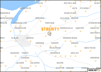
Stagnity (Poland)Stagnity is a town in Poland. An overview map of the region around Stagnity is displayed below.
regional and 3d topo map of Stagnity, Poland ::
Stagnity airports ::
The nearest airport is GDN - Gdansk Lecha Walesy, located 70.7 km west of Stagnity.
Other airports nearby include KGD - Kaliningrad Khrabrovo (105.8 km north east), Nearby towns ::
Dąbrowa (1.1km west) //
Czechowo (3.7km south) //
Piastowo (3.7km north) //
Jagodnik (3.7km north) //
Sierpin (3.9km south) //
Gronowo (4.3km south west) //
Wilkowo (3.7km south east) //
Kamiennik Wielki (3.7km north east) //
Nowina (5.7km south) //
Przezmark (5.7km south) //
Próchnik (6.0km north) //
Komorowo (7.5km south) //
Winnica (4.7km south west) //
Pomorska Wieś (4.7km south east) //
Milejewo (6.4km north east) //
Ogrodniki (6.4km north east) //
Pilona (7.7km south) //
Myślęcin (8.1km south east) //
Pasieki (8.6km south east) //
Zajączkowo (8.6km north east) //
[all distances 'as the bird flies' and approximate]  Places with similar names to Stagnity, Poland ::
// Setegantí (PA)
// Sidgunda (LV)
// Stigniţa (RO)
// Saidgānti (BD)
// Sāutikānda (BD)
// Sitāikunda (BD)
// Sītākund (BD)
// Settigunta (IN)
// Saūdakent (KZ)
// Sütkent (KZ)
Disclaimer :: Information on this page comes without warranty of any kind |
||
|
Where is Stagnity? Elevation and coordinates ::
Latitude (lat): 54°11'0"N Longitude (lon): 19°30'0"E
Elevation (approx.): 149m (map arrows pan, magnifying glasses zoom) |
||
|
Visiting Stagnity? Hotel/Accommodation ::
Book a hotel in Stagnity Travel Guide ::
Buy a travel guide for Poland rental cars ::
car rental offers GPS waypoint ::
download a GPX waypoint (PoI) of Stagnity for your GPS receiver
|
||