|
search place name
|
||
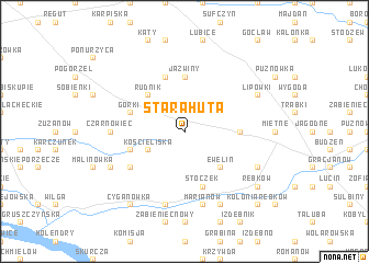
Stara Huta (Poland)Stara Huta is a town in Poland. An overview map of the region around Stara Huta is displayed below.
regional and 3d topo map of Stara Huta, Poland ::
Stara Huta airports ::
The nearest airport is WAW - Warsaw Okecie, located 44.8 km north west of Stara Huta.
Other airports nearby include RZE - Rzeszow Jasionka (206.1 km south), KRK - Krakow Balice (239.0 km south west), Nearby towns ::
Łucznica (1.9km north) //
Kościeliska (2.9km south west) //
Budy Uśniackie (2.9km south west) //
Pilawa (2.9km north east) //
Ewelin (4.4km south east) //
Rudnik (4.4km north west) //
Jaźwiny (5.6km north) //
Krystyna (3.4km east) //
Władysławów (3.9km south west) //
Natolin (3.9km south west) //
Augustówka (5.7km north) //
Grabianka (5.7km north) //
Górki (3.9km north west) //
Stoczek (5.7km south) //
Uśniaki (5.0km south west) //
Czarnówiec (4.6km west) //
Marianów (7.5km south) //
Trzcianka (7.5km south) //
Wilkowyja (7.8km south) //
Wola Władysławowska (5.9km south west) //
Wola Rębkowska (5.9km south east) //
Lipówki (5.9km north east) //
Cyganówka (8.2km south west) //
Rębków (7.2km south east) //
Kolonia Rębków (8.7km south east) //
[all distances 'as the bird flies' and approximate]  Places with similar names to Stara Huta, Poland ::
// Stara Huta (PL)
// Stara Huta (PL)
// Stara Huta (PL)
// Stara Huta (PL)
// Stara Huta (PL)
// Stara Huta (PL)
// Stara Huta (PL)
// Sederhat (RO)
// Stara Huta (UA)
// Satterwhite (US)
Disclaimer :: Information on this page comes without warranty of any kind |
||
|
Where is Stara Huta? Elevation and coordinates ::
Latitude (lat): 51°56'0"N Longitude (lon): 21°30'0"E
Elevation (approx.): 161m (map arrows pan, magnifying glasses zoom) |
||
|
Visiting Stara Huta? Hotel/Accommodation ::
Book a hotel in Stara Huta Travel Guide ::
Buy a travel guide for Poland rental cars ::
car rental offers GPS waypoint ::
download a GPX waypoint (PoI) of Stara Huta for your GPS receiver
|
||