|
search place name
|
||
Straszewo (Poland)Straszewo is a town in Poland. An overview map of the region around Straszewo is displayed below.
regional and 3d topo map of Straszewo, Poland ::
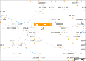
Nearby towns ::
Grzybowce (2.2km north west) //
Bielewicze (2.9km south west) //
Mieleszki (4.3km south west) //
Zarzeczany (3.3km west) //
Skroblaki (5.0km north east) //
Kolonia Mieleszki (6.0km south) //
Grudki (4.5km west) //
Józefowo (7.4km north) //
Szaciły (7.4km north) //
Nietupa (7.5km north) //
Krynki Białostockie (4.8km south east) //
Werobie (4.8km north east) //
Podozierany (8.1km south east) //
Oziabły (8.6km south west) //
Wiejki (8.6km south east) //
[all distances 'as the bird flies' and approximate] 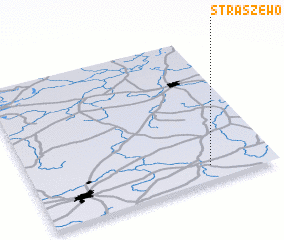 Places with similar names to Straszewo, Poland ::
Disclaimer :: Information on this page comes without warranty of any kind |
||
|
Where is Straszewo? Elevation and coordinates ::
Latitude (lat): 53°6'0"N Longitude (lon): 23°44'0"E
Elevation (approx.): 164m (map arrows pan, magnifying glasses zoom) |
||
|
Visiting Straszewo? Hotel/Accommodation ::
Book a hotel in Straszewo Travel Guide ::
Buy a travel guide for Poland rental cars ::
car rental offers GPS waypoint ::
download a GPX waypoint (PoI) of Straszewo for your GPS receiver
|
||