|
search place name
|
||
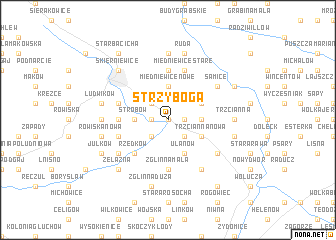
Strzyboga (Poland)Strzyboga is a town in Poland. An overview map of the region around Strzyboga is displayed below.
regional and 3d topo map of Strzyboga, Poland ::
Strzyboga airports ::
The nearest airport is WAW - Warsaw Okecie, located 59.5 km north east of Strzyboga.
Other airports nearby include KTW - Katowice Pyrzowice (178.5 km south west), KRK - Krakow Balice (206.6 km south), RZE - Rzeszow Jasionka (238.1 km south east), Nearby towns ::
Rawiczów (0.0km north) //
Kolonia Strobów (1.1km west) //
Budy-Strzybowskie (1.1km east) //
Podtrzcianna (2.2km north west) //
Rzędków Nowy (2.2km south west) //
Franciszkany (2.2km south east) //
Strobów (2.3km west) //
Miedniewice Nowe (3.7km north) //
Adamów (2.3km east) //
Pamiętna (2.9km north east) //
Trzcianna Nowa (2.9km south east) //
Kawęczyn B (3.9km south) //
Ulanów (3.9km south) //
Rzędków (4.4km south west) //
Zglinna Mała (5.6km south) //
Kazimierzów (5.6km south) //
Krzyżanów (5.6km south) //
Miedniewice (5.6km north) //
Balcerów (3.4km west) //
Sadowiczów (3.9km north west) //
Miedniewice Stare (5.7km north) //
Pruszków (3.9km south west) //
Dukaczew (6.0km south) //
Samice (5.0km north east) //
Kawęczyn Nowy (5.1km south east) //
Kaczorów (5.1km south east) //
Józefatów (5.1km south west) //
Grabina (7.4km north) //
Trzcianna (4.6km east) //
[all distances 'as the bird flies' and approximate] 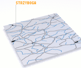 Places with similar names to Strzyboga, Poland ::
// Staersbeck (DE)
// Stara Subocka (HR)
Disclaimer :: Information on this page comes without warranty of any kind |
||
|
Where is Strzyboga? Elevation and coordinates ::
Latitude (lat): 51°55'0"N Longitude (lon): 20°12'0"E
Elevation (approx.): 134m (map arrows pan, magnifying glasses zoom) |
||
|
Visiting Strzyboga? Hotel/Accommodation ::
Book a hotel in Strzyboga Travel Guide ::
Buy a travel guide for Poland rental cars ::
car rental offers GPS waypoint ::
download a GPX waypoint (PoI) of Strzyboga for your GPS receiver
|
||