|
search place name
|
||
Szpinalów (Poland)Szpinalów is a town in Poland. An overview map of the region around Szpinalów is displayed below.
regional and 3d topo map of Szpinalów, Poland ::

Szpinalów airports ::
The nearest airport is KTW - Katowice Pyrzowice, located 89.1 km south of Szpinalów.
Other airports nearby include KRK - Krakow Balice (130.3 km south), WAW - Warsaw Okecie (145.9 km north east), OSR - Ostrava Mosnov (196.8 km south west), Nearby towns ::
Ożga (1.2km west) //
Aleksandrów (1.2km east) //
Danielów (1.9km north) //
Ochocice (2.2km south east) //
Kamieńsk (2.2km south east) //
Podjezioro (2.2km north west) //
Napoleonów (2.2km north east) //
Siodemka (3.7km north) //
Koźniewice (3.9km south) //
Gałkowice Nowe (3.0km north west) //
Włodzimierz (3.9km north) //
Pytowice (4.4km south west) //
Barczkowice (4.4km south east) //
Gałkowice Stare (4.4km north west) //
Pawłów Górny (5.6km north) //
Słostowice (5.7km south) //
Wojciechów (5.7km south) //
Budy Porajskie (3.9km north east) //
Przydatki (5.7km north) //
Chruścin (5.1km south east) //
Pila Ruszczyńska (5.1km south west) //
Gomunice (7.4km south) //
Kolonia Ruszczyn (4.6km west) //
Żuchowice (4.6km east) //
Pawłów (7.4km north) //
Gorzędów (5.0km east) //
Pawłów Dolny (7.5km north) //
Pawłów Szkolny (7.5km north) //
Poraj (6.6km north east) //
[all distances 'as the bird flies' and approximate] 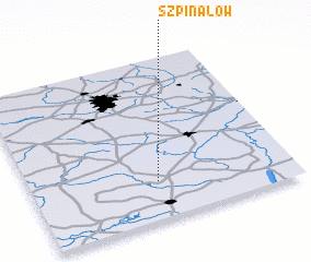 Places with similar names to Szpinalów, Poland :: Disclaimer :: Information on this page comes without warranty of any kind |
||
|
Where is Szpinalów? Elevation and coordinates ::
Latitude (lat): 51°14'0"N Longitude (lon): 19°29'0"E
Elevation (approx.): 217m (map arrows pan, magnifying glasses zoom) |
||
|
Visiting Szpinalów? Hotel/Accommodation ::
Book a hotel in Szpinalów Travel Guide ::
Buy a travel guide for Poland rental cars ::
car rental offers GPS waypoint ::
download a GPX waypoint (PoI) of Szpinalów for your GPS receiver
|
||