|
search place name
|
||
Walendziuki (Poland)Walendziuki is a town in Poland. An overview map of the region around Walendziuki is displayed below.
regional and 3d topo map of Walendziuki, Poland ::

Walendziuki airports ::
The nearest airport is WAW - Warsaw Okecie, located 132.2 km west of Walendziuki.
Nearby towns ::
Łojki (1.9km north) //
Turna Duża (2.2km south east) //
Słochy-Annopolskie (2.3km west) //
Turna Mała (3.9km south) //
Wólka (4.3km south west) //
Binduga (5.6km south) //
Kózki (5.7km south) //
Siemiatycze (5.7km north) //
Słowiczyn (5.7km north) //
Klimczyce (5.7km south) //
Anusin (3.9km south east) //
Bużka (6.0km south) //
Baciki Średnie (6.0km north) //
Boratyniec Ruski (4.5km east) //
Olendry (4.9km east) //
Chlebczyn (7.5km south) //
Laskowszczyzna (7.5km north) //
Franopol (7.5km south) //
Ogrodniki (4.9km west) //
Baciki Bliższe (6.5km north east) //
Fronolów (5.8km south east) //
Rogawka (5.8km north west) //
Czartajew (7.8km north) //
Lipno (7.8km south) //
Rozwadów (8.2km south east) //
Baciki Dalsze (8.2km north east) //
[all distances 'as the bird flies' and approximate] 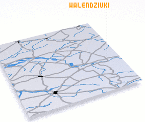 Places with similar names to Walendziuki, Poland :: Disclaimer :: Information on this page comes without warranty of any kind |
||
|
Where is Walendziuki? Elevation and coordinates ::
Latitude (lat): 52°24'0"N Longitude (lon): 22°52'0"E
Elevation (approx.): 133m (map arrows pan, magnifying glasses zoom) |
||
|
Visiting Walendziuki? Hotel/Accommodation ::
Book a hotel in Walendziuki Travel Guide ::
Buy a travel guide for Poland rental cars ::
car rental offers GPS waypoint ::
download a GPX waypoint (PoI) of Walendziuki for your GPS receiver
|
||